
 |
|
Outback Winter Trip July 2014 [It's in reverese order because it's a reproduction of daily blogs. Sorry!] Cunnamulla to Hillston 14 August Having missed out on arriving catching up with the one person I know in Cunnamulla, Louise, a cousin of my stepdaughters, Nicole and Natalie, I managed to do so at her workplace, the Primary School, before I set out; and scored a bacon and egg breakfast left over from a function that had just finished. Louise’s husband is a police officer attached to the Cunnamulla station. My first attempt to make contact this morning was to ring the police number effective all over Australia for the area called from: 131444. I asked the woman who answered if she was in Cunnamulla. - No, I’m in Brisbane - Can you put me through to the Cunnamulla station please? - How do you spell that? - C U N N A M U L L A. - Is that N for Nancy or M for Mary? - N for Nancy. - So C U N N A N U…. - No, that one’s an M for Mary. - Ah! So C UN N A M U L L A. - That’s it. - Ah! There it is. - Good, can you put me through please. I can understand why you’re told at the outset to hang up and dial 000 if you’re in a hurry!
Bourke has some special significance for me. My great grandfather owned a wool barge and steamer; and transported wool from Bourke and downstream stations to Wentworth at the confluence of the Darling and Murray Rivers. This is the second time I have passed through Bourke in something of a hurry, so look forward to spending some more time here one day exploring the area. At Bourke, the main highway from Cunnamulla continues onto Nyngan. I came up that way last year, so opted for Kidman Way, whose northern end is at Bourke. That would take me to Cobar where I have never been.
I need to come back to Cobar. It’s a town with lots of history relating to mineral discoveries and mining. Sadly, my exposure to that today had to be very superficial. Cobar was originally renowned for its copper deposits and copper mining. Its entry sign epitomises this aspect of its history. That dates back to the late 1800s. More recently – within decades past – many other minerals have been discovered leading to a revival of the town’s fortunes. Gold has been a big factor in this revival. The New Cobar Gold Mine, on the outskirts of the town, is a large open cut mine with a decline into the underground mine emanating from the floor of the open cut. This can be viewed from an amazingly located viewing platform.
This would be another 250 plus km ride to the next “decent” stop, but with a small hamlet and a tiny hotel at the 160km mark as a fall-back in case time or weariness got the better of me. With both pushing at their limits, I battled on to Hillston, arriving only 15mins after the 4:00pm Happy Hour start for wildlife. That would be a 686km ride. Far more than any planned day. More than I’d care to do in a day. More than I had done in any other day of the trip. But still almost 30km short of a day’s ride between home and Phillip Is.
This would be my last commercial stopover, so I opted for a motel rather than the normally preferred town pub. I’d no sooner parked my bike and started to unpack, when another guest said “You look like you could do with a beer.” Whereupon he produced a cold can of XXXX. “Thank you.” He was one of a group of guys, travelling in three utes with trailers full of gear and carrying a couple of tinnies. They were on their back to Victoria after their annual fishing and shooting (feral pigs) trip along the Darling River – and taking in the annual Louth races. As we stood in the parking area chatting about one another’s trips, the owner of the motel (the Victorians were regular visitors) turned up with another round of beers for all. I couldn’t complain about the hospitality. The forecast rain didn’t eventuate but there were more dire forecasts on the news tonight. The now shortened ride to Wagga Wagga to confront my 2½ yr old grandson, who has taken undue pleasure from watching Granddad stack, may be easier if the rain arrives. Windorah to Cunnamulla: 13 August
The ride from Windorah to Quilpie was possibly the coldest of the trip, including the first day out of Canberra. Admittedly I had two layers fewer today. The sun shone but the air and slight breeze were chilling. Most of the road was the narrow single vehicle strip of bitumen with a few wider stretches interspersed. I had three road trains to contend with, meaning that I had to ride (slowly) onto and stop on the loose stones that mostly formed the shoulder. The etiquette is that any vehicle, including 4x4s towing large caravans, moves completely off the bitumen strip and stops to let oncoming road trains, which might be four trailers long, go past on the bitumen
I’d have to say that Quilpie, small as it is, was a very welcome sight. I was chilled to the bone with frozen fingers, having foolishly pushed on when common sense told me to stop and add a layer. As it was, I had winter gloves for the only time since the first two days out of Canberra and the heated grips turned up high! It was a two and a half hour ride so the 10:30am breakfast in Quilpie was heavenly, even though the best I could do was a toasted sandwich and a cup of local coffee.
The ride along the back roads to Cunnamulla was possibly the most pleasant of the Outback roads. It was almost totally mine alone. Lots of wildlife as noted above. I think one of the road trains I met was on this stretch. I’d put my rain jacket on in Quilpie, so stayed warm (not anticipating an early arrival of the rain band; simply for warmth). The scenery alternated between plains uninterrupted, scruffy scrub, red rocks and earth, and occasional mini-ranges that peeped over the plains.
From Eulo to Cunnamulla, it was basically more of the same as regards road conditions and scenery. Across the vey muddy Warrego River brought me to downtown Cunnamulla. The centrepiece of the town is a large sculpture of the “Cunnamulla Fella” made famous by a song written by Stan Coster and first sung by Slim Dusty and later by Lee Kernaghan. It’s a tribute to the stockman DNA of the countryside. Alpha to Windorah: 12 August
It was then a 100km run to Longreach; and with time to spare, it was an indulgent morning tea stop, with a little too much time spent at the fabulous Outback Station shop, which did well from me on my 2009 visit. With some difficulty, I resisted the temptation to buy anything. The 320km from Longreach to Windorah was along the Thomson Development Road. Queensland has lots of these “development roads.” Essentially they are roads under construction or, more accurately, development. Some are gravel both good and bad; some are double lane bitumen but without marked lines; and some are single lane bitumen. This one was largely single lane but with short stretches of wider road every 30-40km with indications of “overtaking opportunity” ahead.
This area is called “channel country” seemingly because scarce water, when available, is distributed via “channels” which seemed little more than natural creeks – dry for now. Finally Windorah came up with three litres left in my tank.
It was tempting to stay on for another day, but I had planned a roundabout itinerary back into the Outback to compensate for the sudden change of plans I had to make to head for Brisbane at the outset of the trip instead of taking my planned inland route. To stick to that, spend time in Wagga Wagga with family, and arrive back home as scheduled, I needed to keep going.
Once reaching the Capricorn Highway taking me to Alpha, there was a pleasant relief from the flat open plains by crossing a range that rose a few hundred metres via an unexpectedly twisting road that provided a brief chance to warm the sides of the tyres.
The chef, whom I met delivering my dinner to the table, was a distinguished looking gentleman of obvious Indian origin. Turns out he was from South Africa (Durban) who migrated to Australia some 40 years ago. I learned he is 67. Afton Downs to Mackay: 8-10 August
Graeme and I rode out together as far as the front gate (7km); then as he headed south with a brisk tail wind, I rode north with an equally brisk head wind. After a refuel stop in Hughenden, it was half head and half cross wind east to Charters Towers.
Getting out of Charters Towers was a challenge because of a large cycling criterium event on a circuit through the main streets of the town. I got an early start so had time for a couple of leisurely stops on the way. This second day segmenrt took me from the flat dry plains to the coastal ranges and the green lushness of the coastal strip as I headed south to mackay with a wind that had now changed from a nor’easter to an even stronger sou’easter.
Then it was onto Mackay for two nights with special friend Ros (aka Roz). Her house is set on a promontory overlooking with unhindered views of the ocean and coast line, with the distant silhouettes of coal ships waiting to be loaded at nearby Hay Point. (Inland from Mackay are several massive open cut coal mines as well as several underground mines.) It was nice to spend a quiet catch-up day with Ros on Sunday 10 August and enjoy dinner with a few of her friends with whom I have become well acquainted from previous visits. Afton Downs: 5-8 August
On another day, we were dispatched to do some local sightseeing so Kay had some organising time to herself.
About 13km south of Hughenden is a long ridge that comes out of the plains like the monolith in the movie 2001… At its top are several lookouts facing in all four compass point directions, although the view is very similar in all directions: a flat, mostly treeless “wide brown land” with the town of Hughenden vaguely distinguishable to the north. Back to Afton Downs, the old shearing shed is a treat. Built in the late 1800s, it is now a tumbling down reflection only of its glory days. Afton Downs ceased being a sheep station about 25 years ago. There’s a photo from last year at the bottom of this page.
On Friday (8 Aug) we all departed, as we came, in different directions. Except that we all swapped directions. I headed to Hughenden and onto Charters Towers for the night en route to Mackay. Graeme headed south to Winton and onto wherever. Kay and Gerard went to Cairns to prepare for their Cape trip. Longreach to Afton Downs: 5 August
As we headed further west the countryside kept getting flatter. The stretch of road from Longreach to Winton had another characteristic, namely a high proportion of road kill. Somewhat anomalously the only live wildlife I saw all the way were two emus, a small kangaroo and a few brolgas. This was in stark contrast to last year in the same place at much the same time when ‘roos and emus abounded. Perhaps the prolonged drought has taken its toll on wildlife as well as stock and stations.
From Winton, we turned north onto the Hughenden Road. The 185km (just 26km short of Hughenden) was boringly straight but provided amazing vistas of a countryside dry and dead flat to the far horizons. A long-ago railway line embankment follows the road with only the pylons left of the bridges over the numerous creeks and floodways. The tiny hamlet of Stamford – only a road house there today – has the remnants of a couple of sidings, a station and water tank. Obviously quite a key railway centre in its day even though it’s only about 60km from Hughenden.
The last few hundred metres to the homestead cross another grid and bring you into the home paddock. The last few dozen metres must have had the only bit of water seen along the way (thanks to Kay’s zealous lawn watering), which provided a mud trap for the unwary! I could easily have gone round it. I soon wished I had done so. Not that Kay or Graeme, who had arrived about an hour earlier from the opposite direction to us, were concerned or even aware of my unorthodox arrival, since they were already enjoying, so they were to attest, coffee….but ‘with a twist’ (or two or three)! (Kay was renown on our Himalaya Tour for adding a ‘twist’ of Kahlua each morning to our coffees.) In the absence of Kay and Graeme, we were greeted warmly and appreciatively by Gruffers the goat and Purdie the Bantam rooster. Posted 8 August Mitchell to Longreach: 4 August
It was surprisingly mild to head out at 7.50am after a quick breakfast at the café. The GPS for reasons known only to itself tried to take me onto non-existent roads as I headed out of town. Once it realised I was ignoring it, it seemed to settle and told me I should turn in 505km. That was obviously going to be a long run before the next instruction! Mild soon turned to cold; and another layer was required. The short As the kms ticked by, dark clouds heralded rain to the North and East (I was travelling north at this stage); but that didn’t worry me as I was at some stage, hopefully before the rain, to turn West. I must have caught a trailing edge of the rain band, as it came across with accompanying darkness and provided blinding passage overtaking road trains with their three trailers.
The last leg West to Longreach was uneventful despite the increased spread of road kill along the highway. The Qantas Boeing 747 was clearly obvious from the far approaches to Longreach. Longreach, of course, was where the fledging airline called “Queensland and Northern Territory Air Services” started and soon took on the acronym of QANTAS. The story of the arrival of its B747 is epic in itself. You can whet your appetite on this story with my You Tube video: http://youtu.be/tDJOtwGUAcI Mitchell: 3 August
Unfortunately I missed the billboard coming into Mitchell announcing the ‘Great Artesian Spa”. I discovered it on a post-shower walk, by which time it was too late to indulge. It would have been a welcome end to a 586km ride. The day’s ride from Brisbane was quite cold until after a second breakfast stop at Toowoomba – about three hours into the ride. Even so, it wasn’t until lunch at Miles that I peeled off a couple of layers. The first variation to the flat country stretching inland from Brisbane was the Great Dividing Range, as was the case coming in across Cunningham’s Gap. This time it was a climb up the escarpment to Toowoomba via a “pass” but I didn’t notice if it has a name. Toowoomba sits at the top of the pass seemingly right on the highest parts of the Divide. With There was an indiscernible drop on the other side as the road headed west onto the Darling Downs – the beginning of the wide tablelands into and across the Outback. I noticed on the GPS that the elevation west of the escarpment was over 400m but I forgot to check the plains west of Brisbane. I suspect there was very little elevation before the climb into Toowoomba. Onto the Darling Downs brought some cold windy conditions, but the obviously rich farming and grazing country clearly revealed why the Darling Downs has a reputation for its productivity. The farming (lots of wheat) )and grazing (both sheep and cattle) are shared by coal mining. Wheat silos rise along the railway line in several places; and in between some of them are coal piles and loaders. Hopefully a continuing “peaceful coexistence”. At times the vast expanse of the plains was blocked by fairly dense wooded stretches but they seemed to be mostly along the road as breaks in the bush revealed open country behind the trees.
Going through Roma was a stark reminder that the land was morphing into cattle country big time. The roadside cattle yards of Roma were teeming with guests waiting for the sellers and buyers to decide their fate. By the time I reached Mitchell it was 3:40 and the day was taking its toll. From Home to Brisbane: 30 Sept-1 Aug Day One was a relatively short 400km, so didn’t feel compelled to an early start. It was a multi-layered ride with a morning temperature of about 9°C. The roundabout way through Bungedore and Tarago always beats the Federal Highway, but the strong cold cross wind did make for a warm-up coffee stop in Goulburn.
Day Two had a magic start. The first part of the day was through the Bylong Valley: a twisting road down into the expansive farm-land and coal-mining (underground) valley, several up-and-over spurs of tightly curved roads in wooded areas all interspersed with open plains to the far ridges of the valley walls, and finally the climb onto the exiting flat country.
The third day leg was another shortish one with the attraction of crossing Cunningham’s Gap through the ‘Main Range’ leading from the western highlands down onto the plains that bring you into Brisbane. It’s a very short ride up from the western side but a longer ride down the eastern side. I’m not sure what defines a ‘gap’ as opposed to a ‘pass’ or the several other words used for much the same geographic formation. To me it was less of a ‘gap’ and more of a ‘pass’ (i.e. a way of crossing the range). What a great experience to meet my latest newest grandson. Kai is the three month old son of Natalie, one of my two beautiful stepdaughters. Natalie lived with me for a couple of years over ages of 18-20 or thereabouts. We shared some interesting and special experiences. Introduction
Our destination, at which we’ll all arrive separately, is the Outback Queensland cattle station of Afton Downs: that’s because the manager is one of our number. Map of the Trip This has been a moveable feast. But the route on the map below is firming! The blue marker sits on my house roof. The blue line is my planned route to Afton Downs. The diversion to Brisbane is to visit my recently born first step grandson. The red marker is the destination- the entrance to Afton Downs. The yellow house is the actual homestead. You can zoom right in and separate the markers to see what the countryside is like. The red line is my intended route home.
View in a larger map Winter Trip to Afton Downs 2014 Trip Starts 30 July
I’ll start by getting off the highways from the outset and ride via Bungendore and up the Goulburn-Oberon road. The first night’s stop will be Kandos. Then through the Bylong Valley and up the New England Highway to Tenterfield. From there it will be a relatively short run into Brisbane. After a couple of nights in Brisbane, I’ll head due West for a couple of days stopping over at Mitchell and Longreach before arriving at Afton Downs on the third day. Then head East to the coast and down to Mackay. From there five straight days exploring a few new roads and country towns first heading West before dropping South. I’ll be trying to write something as I go along. I intended to do that last year but didn’t! |
.jpg?81) Three days out from Mackay the weather forecast for 11 august was “morning showers”. However, Monday 11 August dawned with an absolutely clear blue sky with an almost miraculous disappearance of the gusty sou’easter that had unrelentingly kept us company all Sunday.
Three days out from Mackay the weather forecast for 11 august was “morning showers”. However, Monday 11 August dawned with an absolutely clear blue sky with an almost miraculous disappearance of the gusty sou’easter that had unrelentingly kept us company all Sunday..jpg?81) Today’s ride from Mackay to Alpha started with sights and smells of sugar cane mills – already experienced on the way into Mackay. Once back onto the Outback plains, I had planned to take some back roads – those “less well travelled”. These took me through significant coal mining areas and through the middle of gem stone mining areas with lots of small settlements selling local and imported gem stones and jewellery.
Today’s ride from Mackay to Alpha started with sights and smells of sugar cane mills – already experienced on the way into Mackay. Once back onto the Outback plains, I had planned to take some back roads – those “less well travelled”. These took me through significant coal mining areas and through the middle of gem stone mining areas with lots of small settlements selling local and imported gem stones and jewellery. .jpg?81) Alpha is not a big town. In fact, it’s a very small, somewhat unimpressive town. The Alpha Hotel Motel, the only accommodation in town apart from the caravan park, made me hesitant that I was in the right place. There was a very elderly greyed gentleman sitting out front, reminding me of an ancient retainer from Russian literature belonging to a pre-revolutionary country dacha, whom I assumed was a patron. He was the only person in sight and surprised me when he followed me into the bar. He was barman, motel manager, dinner order taker and anything and everything else.
Alpha is not a big town. In fact, it’s a very small, somewhat unimpressive town. The Alpha Hotel Motel, the only accommodation in town apart from the caravan park, made me hesitant that I was in the right place. There was a very elderly greyed gentleman sitting out front, reminding me of an ancient retainer from Russian literature belonging to a pre-revolutionary country dacha, whom I assumed was a patron. He was the only person in sight and surprised me when he followed me into the bar. He was barman, motel manager, dinner order taker and anything and everything else.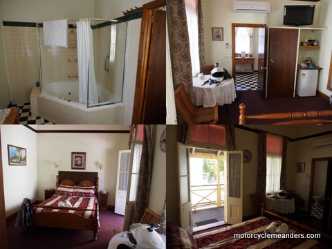 This was my second stay at the Royal Hotel in Charters Towers. It was obviously a grand old hotel in its day, with an expansive wrought ironed veranda along two sides. Today it’s a beautifully restored “private hotel”. That used to be a common expression but you don’t hear it much today. Essentially it’s an accommodation establishment without alcohol or meals provided.
 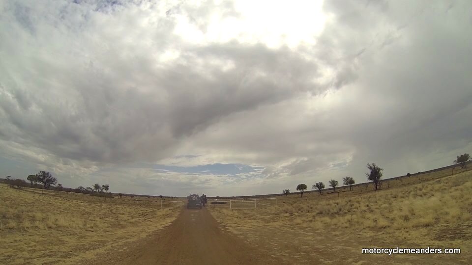 This was the last leg to my destination of the Outback cattle station of Afton Downs. At only 387km it would be a relatively short ride. And I had company for this last leg. Gerard, friend from a few overseas tours – as are all of us gathering at Afton Downs – had arrived in Longreach at much the same time as I did, having travelled from South Australia by 4x4 with his DR650 on a trailer (Kay and Gerard are riding to the Cape after our sojourn at Afton Downs).
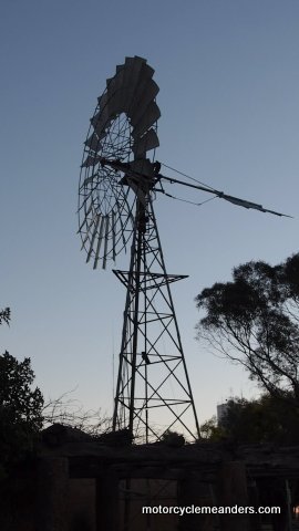
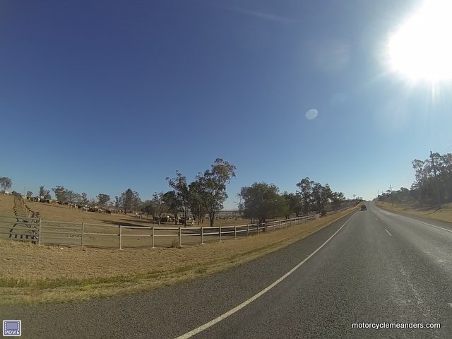
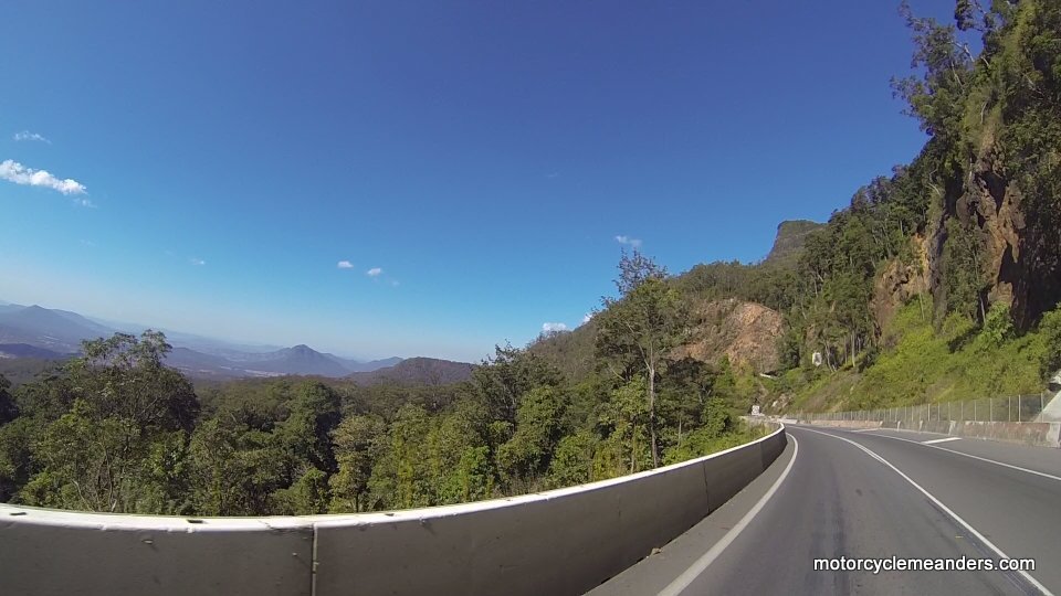 However, once onto the New England Highway at Muswellbrook and into open country, the wind was a constant companion all the way up the highway. As the road proceeds through the New England region, it rises to over 1400m explaining why it gets so cold. I had Tenterfield as my destination, but called it quits at Glen Innes. I had spent a lot of time in the Bylong Valley stopping for photos.