 |
|
Kirtling June 2010
You might well wonder where Kirtling is and why I would not only visit it but spend six days there. It’s the place where my great grandfather, William Crick, was born and worked until, at the age of nineteen, he and his brother, Thomas, aged 21, with their cousin, Charles, aged 19, emigrated to South Australia. It’s also where his parents and their parents lived, worked, died and were buried. I have written about them in Kirtling Cricks Part 1 and Kirtling Cricks Part 2. While I took an interest in Kirtling once I started to look into my ancestry, it was only after I decided to try and write a story about William Crick that I felt the need to visit Kirtling and better understand what life would have been like.
Overview of Kirtling Today
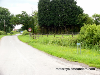
There’s no A or even B rated roads that go to or through Kirtling. There are only hedge-lined country lanes that wind around several small villages in the area, a few of which lead into Kirtling. But you would never come across Kirtling unless you deliberately set out to get there; and even then, you couldn’t be sure you would. You won’t get a signpost to Kirtling until you’re at one of the neighbouring villages two or three miles away. People who offered their postal addresses added ‘near Newmarket, Suffolk’ even though Kirtling is in Cambridgeshire – otherwise the mail might get delayed or lost!
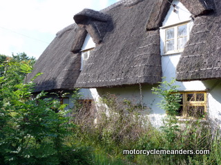
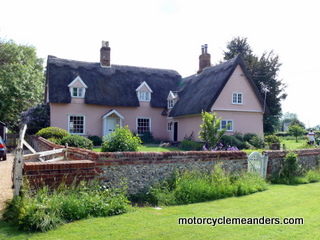
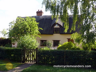
Kirtling today, in population terms, at around 300, is about one third the size it was in the 1850s, despite the fact that, by then, the agricultural sector was already undergoing significant changes that had reduced employment numbers amongst farm labourers. That means, amongst other things, that many of the farm labourers’ houses of the 1850s have disappeared. But what does remain are many of the original thatched-roof cottages that have stood in their place since those days and, in some cases, for up to 500 years. They have been renovated for modern life, but they remain part of the tapestry of Kirtling as so many generations have known and felt it.
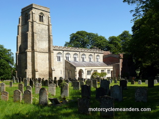
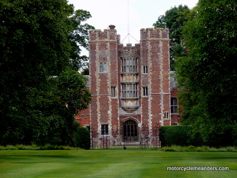
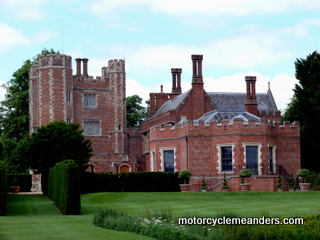
The ‘Estate’ still exists. Some of its former glory has been lost, but that started in 1801 with the demolition of the great Catledge (or Kirtling) Hall. It remains represented by the dominant landmark of Kirtling Tower, the gate house of the former Catledge Hall, and now the central feature of the manor house of the ‘Estate.’ The ‘Estate’ also remains a dominant factor in Kirtling life as owner and operator of most of the farm land – and a good deal of the housing – in and around Kirtling. The ‘Estate’ – or, more precisely, the Lord and Lady of the manor – inevitably became a subject with almost everyone I spoke with in Kirtling. All Saints church, as much a centrepiece of Kirtling as Kirtling Tower and the ‘Estate’, has been resurrected by the community from a sad state of decline of some years ago and now proudly dominates its end of the wide-spread Kirtling settlement. It became for me, over six or seven visits, the epitome of the Kirtling I wanted to know and understand. After all, it was in this church – looking pretty much as it did in the 1800s (and long before that) – that my forebears were baptised, married and sent for burial in the surrounding churchyard, although their headstones, if ever they had them, were undiscoverable.
Description of Kirtling
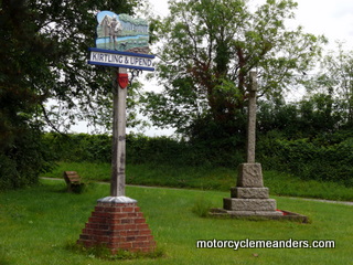
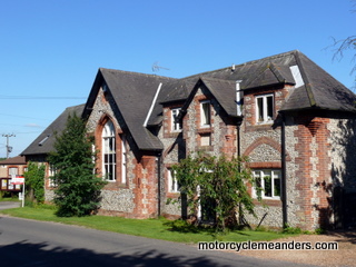
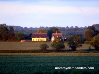
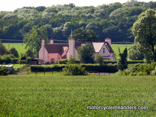
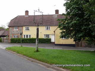
Kirtling is, in fact, three or four small pockets of settlement, mostly strung along a series of country lanes that link up to form, in effect, a ring road, which, you could say, starts and ends at the old Queen’s Head and adjacent Kirtling and Upend signpost. Most of the land inside the ring road and surrounding it is farm land – crops of barley, wheat and canola. If you start at the old Queen’s Head in an anti-clockwise direction, you travel along ‘The Street’ or Kirtling Street (it gets called both). The old 1850 school house is on The Street, as is some terrace housing of the 1840s and 1860s, built by the ‘Estate’ and rented by the tenant farms to house their farm labourers. The former forge is there, together with a couple more of the old pubs, and Parsonage Farm, one of the former tenant farms. There are also a few clusters of 20th century housing. Strung along The Street are several old thatched-roof cottages from former eras, although not all still wearing their thatching.
At the melding of The Street and this eponymous road, there is a branch road to Wooditton. Modern signage marks the road as ‘The Green’, while marking the continuation of The Street as ‘Malting End’. You only get a half kilometre down ‘’The Green’ before another sign tells you it’s actually ‘Wooditton Rd’. When you’re coming out of Wooditton heading for Kirtling, a sign tells you the same road is called ‘Kirtling Rd’. I suspect ‘The Green’ might be part of the community’s understandable effort to accommodate traditional nomenclatures amongst contemporary names.
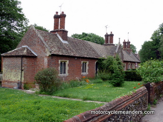
From Mill House, a sharper left hand turn picks up a road coming into Kirtling from Wickhambrook and brings you back to the Queen’s Head. There’s a high probability that the Original Kirtling Cricks came from Wickhambrook, but there’s more work to be done on that. Coming from Mill End, there’s a right hand turn opposite the Queen’s head that takes you to Upend. That’s the fourth settlement that makes up Kirtling, but, in essence, it’s a settlement or village in its own right, although part of the Kirtling parish – both civil and ecclesiastical. If you were to continue past the Queen’s Head, you’d end up, within a kilometre or two, at Kirtling Tower (the manor house of the ‘Estate’), All Saints church, the old vicarage and the alms house. You can take a (rough and ready) drive around Kirtling through the video clips below. They follow the order of the description above. They didn’t come out all that well as I tried to manhandle the camera and cope with the unfamiliarity of a manual gear-change car!
Map of Kirtling and Surrounds View Kirtling and Surrounds in a larger map
Key Landmarks and Institutions of Kirtling Although Kirtling struggles to rate a mention on maps or road signs (just the way its denizens want it), it kept me occupied for six days as I wandered around it, pondered on its history and secrets, and talked to anyone and everyone who wasn’t locked inside their house – and a few who were. There were several places which held memories of the relevant past or represented elements of the lives and fortunes of ancestors. I have tried here to capture what they meant and revealed. Kirtling Tower
The concept of the estate probably had its origins in Roman times, but became an established institution in medieval times, when it became associated with the manor and the feudal system of agriculture. Essentially the term refers to the tracts of land, houses, tenant farms, even (at least, in the past) peasant serfs, and anything else over which the lord of the manor could claim ownership and, therefore, control, rent or allegiance. The manor, the stately home of the lord (and lady) of the manor, was the centrepiece of the estate. Mostly, everyone and everything in the village and surrounding land were beholden to some extent to the estate. In the case of Kirtling, the estate had its origins in landholdings in the area of Kirtling and Upend owned by King Harold at the time of the Norman conquest. With William the Conqueror’s successful invasion and defeat of Harold in 1066, William was quick to take possession of Harold’s estates. Appointees of William gained control over the Kirtling estate and built some form of stockade there as a tangible symbol of ownership and a defence against Saxon raiders. The impact of the Norman invasion of Kirtling and Upend is seen starkly in the clearance of woodland for farming. William’s Doomsday survey of 1086 revealed that the arable land had expanded considerably.
A feature of estate management over the centuries was to rent out farms to tenant farmers. The farms came with a substantial farm house and probably a few hundred acres. This meant that the lord of the manor didn’t have to manage the farming as such; just collect the rent. The estate would build cottages and other living quarters for the farm labourers and rent them to the tenant farmers, who, in turn, would provide them to their labourers. The labourers could also rent small plots set aside by the estate for personal subsistence gardening by them. Once a year the estate agent (origin of a well-used contemporary term?) would come to the local public house and collect the year’s rent on behalf of the estate. Kirtling Tower, the only extant remains of Kirtling Hall – in fact, the latter’s gate house – has been in the Fairhaven family since 1941. Under the current Lord Fairhaven, the tenant farms have disappeared and all the farm land has either been sold or brought under central management by the estate. In reality, however, the trend to consolidation of smaller farms had started around 1800 as part of the agricultural changes that heralded the demise of the farm labourer sector; and eventually lead to most leaving Kirtling, including emigrating to Australia and Canada. The estate, even today, still owns and rents out several houses in the district, although most of its former holdings of dwellings have been sold with freehold titles. The estate still owns about 3000 acres around Kirtling Hall and throughout the Kirtling and Upend area. Its presence is still felt in daily Kirtling life; but not nearly to the extent it would have been in centuries past.
All Saints
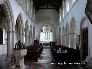
A major extension of the church took place in the 13th century. The nave was widened on each side. The Norman walls of the church were where the archways along the nave now are (see slide show to illustrate this). The roof was realigned. You can still see the original Norman roof line on the back wall of the church. After the Norths became lords of the manor in 1533, the burial chapel and the side chapel were built in the second half of the 16th century.
Essentially, take away the pews and you have a church which looks pretty much exactly as it did when the Cricks first came to Kirtling in the 1780s; and throughout the 1800s, when their children, including Thomas and Sarah, my great great grandparents, were baptised, married, and buried. William Crick would also have been in the church. I spent a lot of time over several visits being absorbed by the reality of being in the same nave, looking at the same walls and many of the same decorations, going through the same doorway, walking in the same churchyard etc as my great grandfather and my greatx2 and greatx3 grandparents.
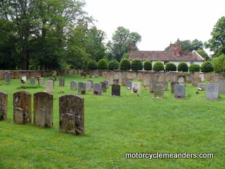
I came across a document from the church records for Wickhambrook, while researching them in the Bury St Edmunds’ Records Office, that listed prices for different forms and sizes of headstones. (I think the Cricks came to Kirtling in the early 1780s from Wickhambrook, so I was looking through church records of that period. Incidentally, Bury St Edmunds is the name of a town.) I assume a similar situation would have applied in Kirtling. I didn’t write down the prices but the message I took away was that it might have been beyond the means of many if not most farm labourers’ families to purchase a headstone.
As a small tribute to the three sets of great grandparents buried at All Saints without, it would seem, any headstones or any readable ones, I arranged for a brass plaque to be made and attached to a wooden bench concreted into the path beside the church. Hopefully, other descendents of the Cricks of Kirtling who might visit Kirtling will feel a greater attachment to its hidden history. Tenant Farms
The system of tenant farms relieved the estate and its lord of the manor from the task of undertaking the farming – or getting their hands dirty. All they had to do was collect the rent, which the estate agent would have done on their behalf. The estate also employed bailiffs to deal with rent defaulters and game wardens to protect the wildlife from poachers.
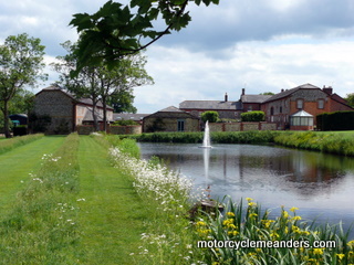
There was usually a Home Farm close to the manor. It usually got a bit more direct attention from the estate and served as a training farm for tenant farmers. In Kirtling, it’s thought that Hall Farm, next to All Saints and just across the moat from Kirtling Hall and later Kirting Tower, might have served this purpose. Place Farm, however, is part of the manor, in effect, so might also have served this purpose. Around the ‘ring road’ are Parsonage Farm, Bachelor’s Hall, Whybrow’s Farm and Pratt’s Green Farm. Close by are other former tenant farms such as Hill Farm, Crabtree Farm and Mill End Farm. Public Houses
At the bottom end of The Street was the Queen’s Head, Kirtling’s longest-established pub until its closure in 1999. Folklore has it that part of Queen Elizabeth I’s entourage stayed there during a visit by her to Kirtling Hall in 1578 because it was the only place that could provide housing for the numbers involved and their horses and coaches. Hence the name. What is certain, however, is that she visited Kirtling Hall. In the 1841 census, William Crick’s eldest sister, Rhoda, is listed as living at Queen’s Head as a ‘female servant’. I had the opportunity of looking through Queen’s Head, which is a private house now. On the top floor, high up into the thatched-roof line, reachable by a narrow and steep staircase, there are a couple of tiny rooms. The narrow hallways leading to them have limited head-height because of the slope of the roof line; and their ceilings follow the roof line down to meet dwarfed walls. I presumed that these might have been the servants’ quarters, leaving the first upstairs floor for travellers’ rooms; and the downstairs for bars and eating areas.
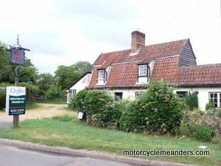
Further up The Street was the former Beehive pub, also now a private house. At the top end of The Street is the Red Lion. It closed only a couple of years ago and still stands exactly as it was when an active pub. It’s been sold and its current owners are exploring the prospects of re-opening it as a pub. (This subsequently happened. You can read about it here.) In the Malting End/Malting Green/Kirtling Green area, there was the Chequers pub and, probably, accompanying brewery. Hence the name ‘malting’. However, it seems that Chequers might have ceased its pub business as long ago as 1847. That might explain why the Street ended up with three pubs, one of which, the Red Lion, is on the edge of this area. Upend had its own pub in the North Arms by 1858. There was a small alehouse there by 1686, but it’s not certain if it was the North Arms. The North Arms closed in 1972.
Housing I At the top was the manor: the lord and lady, their family and even their house servants, who probably fared better than others of their social class. Then there were the tenant farmers, whose houses were a deal larger and presumably better equipped than their workers’.
Finally, there were the paupers. The alms houses were built to accommodate some of them. Sadly the workhouse at Newmarket also provided a place of last resort. I mentioned earlier that one empty and dilapidated duplex thatched-roof cottage on the street currently named ‘The Green’ (in fact, the Wooditton Road) seemed to capture what typical housing might have been like for the Cricks in the 1800s. Some Kirtling Folk
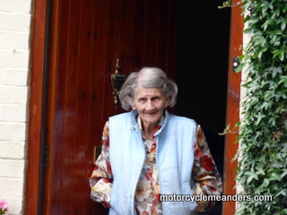
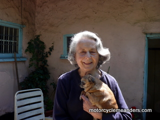
Helen, who ran the B and B at which I stayed (Oakwell House), is a member of the local representative group and so was knowledgeable about current local issues, often relating to development proposals. She was also a great host. We enjoyed a few good wines over dinners! Helen introduced me to Ruby Bell, who lives along The Street. She’s about 90 and was born in Kirtling and has lived there most of her life. She had some great memories, like walking long distances into the fields before school to take her father some breakfast. He was a farm labourer on one of the tenant farms and set out before daybreak each morning to harness the horses and get the ploughing under way for the day. I video’d part of our conversation (see below).
Edward and Eva Johnson live at Hall Farm. They have owned it for several years and extensively renovated it while keeping much of its original structure and charm. Edward, an academic from Cambridge University, provided lots of interesting insights into the history and politics of the estate from its origins and throughout the Norths’ ownership. I later noticed multiple entries in the All Saints visitors’ book by “Oscar Johnson, Hall Farm” ranging over several years, obviously from his first ability to write. I wondered how old he is now; and how embarrassed he might be at reading them today. Col. Tony Tavener owns and lives in the old vicarage. He’s had a full life and was a guiding force in the restoration of All Saints. He had an amazing handle on the many subtleties entwined in the history of the estate and the church. I’d called on him unannounced. He was pretty much chair-bound, so there was a bit of shouting through the back door before I realised he was inviting me in. We had a great yarn for about an hour.
Dick pointed me up the street from his house where Roy Crick lived. Roy pulled out a letter he had received from Margaret McKay (a newly found cousin of mine from Sydney) but to which he had not replied. I discovered that it was his grandfather whose name is on the war memorial in Kirtling (and the All Saints roll of honour). He had a group photo of people outside the old Baptist church in Upend. He could identify his great grandfather and several members of his family. Interestingly, the same photo appears in a booklet on the history of Kirtling produced for a recent anniversary, but gives no indication of who is in the photo. It turned out that I had his great grandfather in my notes and could then trace Roy’s lineage to Edward and Catherine – my greatx3 grandparents, who are his greatx4 grandparents. He was chuffed at that! I thought it interesting that some branches of the Crick tree became non-conformists, while others stayed true to the Church of England. (As an aside, William, my great grandfather, on marrying the Irish Margaret Mungoven in South Australia, became a Catholic, whereas, his brother Thomas, who died relatively young and unmarried, is buried in the Church of England section of Wentworth (NSW) cemetery.) Penny Close was recommended as a good source of historical knowledge; and she was. She’s suffered from MS for years but manages it bravely and stoically, with much dedicated support from her husband. She had lots of records and documents that she accessed with assurance. She also had several insights into farm labourer life.
Barbara Renwick at Upend was an interesting meet. She’s 87, I think she told me. She’s quite a character. We first talked at her gate for ages; and a couple of days later I called back and had a cup of tea in her dolls-house cottage. She was full of stories. As a 14-16 year old, she went to boarding college in Switzerland on Lake Geneva. A close friend, at a near-by boys’ college, was a similarly aged Ninian Stephen, much later to become Australia’s 20th Governor General and a judge of the High Court of Australia. She had stories about their time together skiing and bobsledding; and about his early years at the time. This was on the eve of and at the start of World War II. Barbara went on to join the WRAF and was active through the early years of the war in the groups that monitored the incoming German bombers as well as keeping track of Britain’s bombers over Germany. She then got her commission and went into the Intelligence arm of the WRAF. She had a special romance she still fondly remembers that abruptly ended when her boyfriend was killed in North Africa during the war. She spent many years as a caring aunt for her sister’s children after her sister died in childbirth. She never married. There were others that I enjoyed and valued speaking with, such as the owners of the Queen’s Head and the Beehive, occupants of cottages on the The Street, Kirtling Green (aka Malting End),Mill Road and at Upend, but whose names I did not record. I hope they might read this and send me an email.
A Drive around Kirtling Here are the video clips referred to above. There are seven short videos showing a drive around Kirtling and Upend. The quality is a bit iffy, managing camera and a manual-shift car on narrow country lanes. But they are intended to provide an idea of what Kirtling is like today, which in some ways is probably not all that different to what it was like in the 1800s. Part 1/7: Queen’s Head and along Kirtling Street or, as it is mostly known, The Street.
Part 2/7: Malting End /Kirtling Green/The Green (all the same place)
Part 3/7: Mill End Rd and Mill End
Part 4/7: Mill End to Queen’s Head
Here is a photo album of my visit to Kirtling. The order of photos pretty much follows the description and videos above except Kirtling Tower appears earlier and All Saints appears before Upend. In the censuses of the 1800s, offspring of the original Kirtling Cricks turn up in Wooditton and Great Bradley (as well as other places). That’s why I visited those villages and have included them in the slide show.
|
