South Africa
October-November 2014
Prelude
This tour had emerged before my South India tour. The South India tour came up quite suddenly for the reasons explained on that page. However, from some point of time now lost to me, South Africa was on the agenda for 2014.
This was my first overseas motorcycle tour that was not part of a commercial tour operatror's program. This was a privately organised venture amongst friends. We have all met one another through participation in previous motorcycle tours overseas.
The organisers-in-chief of this tour have been Lesley and David, with whom I’ve been on the Rajasthan, Turkey and Morocco tours. In the organising of the tour, they’re referred to affectionately as Vink & Vink Inc. The tour was solidly based on their inspirational and meticulous planning.
Map of South Africa Tour
Here is a >90% accurate map of our tour route. I might have missed a couple of side trips, but the map got to the point where one more iota of data split it into two pages. That got confusing. You can zoom in and out; and change between map and satellite modes.
We started in Pretoria and finished in Cape Town.
Day-by-Day Guide of the Tour
Not only did David and Lesley plan and organise every aspect of the tour, they produced a very classy day-by-day guide. With their permission I have reproduced their guide here: South Africa Tour Day-by-Day Guide.
Contextual Guide to the Tour
I soon discovered through early research that South Africa has a fascinating history, key aspects of which unfolded in areas that we will traverse. That led inevitably to documenting some of my research, which morphed into a “contextual guide.”
“Contextual?” That might sound a bit obscure! For previous tours I have prepared a “rough guide” highlighting points of interest at every stop. The day-by-day guide covered in the previous paragraph, however, provided this service.
I got involved in researching what we will cover in the tour (as I tend to do in preparing for my overseas motorcycle tours), I was dumbstruck by the enormity of historic interest. Was it any more than on previous tours? Probably not. But there was something intangible about it that grabbed my attention. The so-called “Great Trek” was likely unique in colonial history. The might and achievements of the Zulu certainly were; as was the triangle of power struggles involving the Zulu, the Boers and the British.
So I set out to capture the historical “context” in which so much of these fascinating developments evolved. Hence my Contextual Guide to the Tour.
Lectures on the Tour
Here’s something a bit different. Ahead of the tour, I prepared some lectures on the tour.
I modelled them (very roughly and ineptly) on The Great Courses. The idea was to provide some fairly straight-forward and digestible introductions to and descriptions of a few key social and historical aspects of the tour.
I hoped they might be useful, especially to my fellow participants; but perhaps also to aspirants to undertaking tours of South Africa.
The lectures can be found and accessed on a page dedicated to my “Not So Great Courses”.
The Journey Commences: Johannesburg and Pretoria
After a long and expectant lead time, the South African adventure finally commenced. I was well on the way to the airport by the time the first light of day broke the gloom of the sky; and a few hours into the first day before walking into the Sydney terminal to be greeted by six of our group who had moments before arrived from Melbourne. At the international terminal we became eight – destined to become eleven by the time we ride out of Pretoria in a couple of days.
An interesting flight from Sydney to Johannesburg. Non-stop. Just shy of fourteen hours – and all in daylight. We’d already had about five hours of daylight before we took off; and another four hours after we landed. So 23 hours of uninterrupted daylight and a nine hour time difference between departure and arrival points. Fortunately our group includes two pharmacists, so we had sound counsel to counter inevitable jetlag, customised to suit individual metabolisms. For some it was red wine, for others it was white.
Two of the group who had been on safari in Tanzania were waiting to greet us at Jo’burg and usher us into the waiting vans for the short drive to our suburban guesthouse in Pretoria.
Pretoria
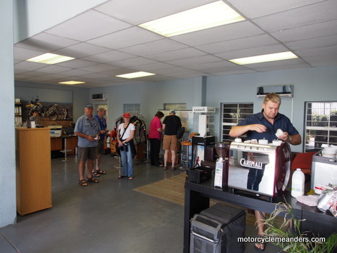 Today saw the group become complete with the arrival of the eleventh member. The focus was then on the paper work for the bikes, with an inspection of a couple of them while the remainder were still being serviced and prepared for the morrow.
 Pretoria is the judicial capital of South Africa (the place where the highest court resides). Other cities fulfil roles of legislative and administrative capitals. Must be the only country that has three capitals. Pretoria is also the centrepiece in much of the
 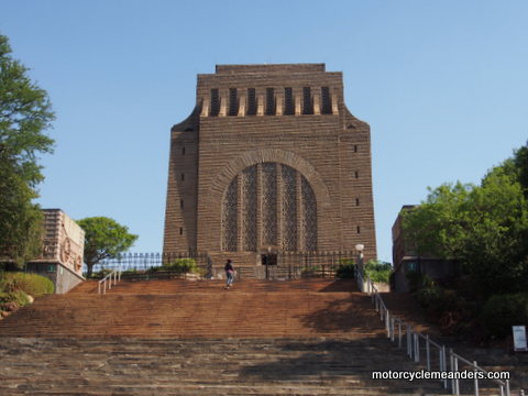 Voortrekkers’ (the Boer farmers of the Great Trek) ambitions to set up their own independent republics free from the control of the British Empire. This is celebrated mightily in the national Voortrekker monument – an art Deco stone and concrete massif that dominates the countryside from the summit of a hill on the outskirts of the city. Fittingly it is surrounded by the open pastures of the high veld that was a key lure and goal of the Voortrekkers.
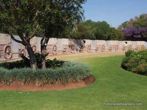 Through sculpture-laden gardens, an internal stone mural encircling the huge domed chamber that constitutes its main body, paintings and an impressively large embroidery, and a museum stocked with Voortrekker memorabilia and dioramas, the monument commemorates and celebrates the most significant historic events of the Voortrekkers. I found it particularly engaging having encountered these events in my pre-tour research presented in the so-called contextual guide. The visit was also a pertinent introduction to the days ahead when we’ll “trek” along many of the routes of the Voortrekkers and visit places where these events unfolded.
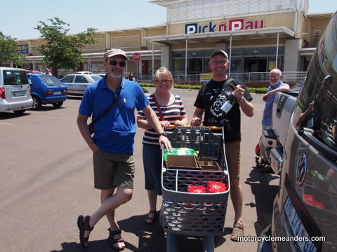
A major task for the day was shopping, including a couple of extra-large Eskies, ice and vital contents that will fortify and embolden us over the course of the tour. The contents, of course, will need regular replenishment.
Pretoria to Magoebaskloof
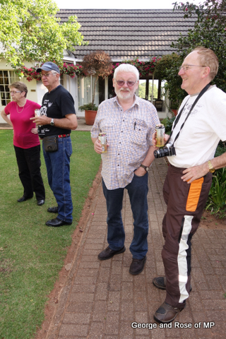
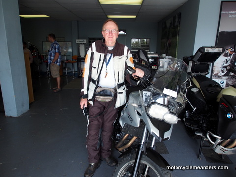 After a provisioning day in Pretoria, we met the bikes in earnest for the first time. That was exciting for most. Paul and Viki had been the only players who had bikes allocated to them when we visited the hire depot the previous day. Paul was particularly wrapped in his brand new (less than 1km on the odometer) R1200GS. However, the pre-allocation got amended. No longer did the coveted bike have Paul’s name on it but had be reallocated to George and Rose. That was momentarily devastating; and it didn’t assuage Paul’s grief to have George “complain” about the smell on new paint!
 That bit of feigned drama aside, we had lined up in front of us our fleet of sparkling BMWs: 3 x R1200GS, 1 x F800GS and 3 x F700GS. With the excitement and anticipation of kids with new toys, we headed out carefully into the Pretoria traffic and onto the main motorway north across the famed high veld that had been at the heart of Boer history for so long.
It was a fairly straight forward ride but none the less engaging to picture the challenges and obstacles the Voortrekkers would have encountered as they struggled over this countryside with ox wagons, herds of livestock and the scores of families that constituted each of the many groups of the Great Trek.
After a couple of hundred kilometres traversing the high veld heading north, as many of the Voortrekkers had done, we changed direction and headed east towards the Drakensberg Mountains. The main groups of Voortrekkers that first headed east across the Drakensberg did so long before we turned east. However, one group – the Louis Trichardt group – crossed pretty much where we headed. As we approached the Drakensberg, the large, long massif of the range loomed larger with each kilometre. It must have been an awe-inspiring and daunting sight for Trichardt and his followers. For us, however, it meant some exciting riding was soon to arrive.
Our stop for the night was a little short of the high point of the range in the area, so the enjoyment for the day was the ascent to the hotel, with the anticipation of the descent to wait.
Magoebaskloof to Baobab Ridge
 This is our first real encounter with the Drakensberg: the Magoebaskloof Pass. The high veld – as the name implies – is a high plateau of mainly grazing country. Some parts of the high veld are in the vicinity of 2000m. By the time we reached our destination yesterday, we were at about 1400m. The pass drops about 450 vertical metres. It’s considered one of the most scenic passes in the Limpopo province; and it didn’t disappoint as it wound its way up and down ranges and valleys before it finally dropped us at the bottom.
 Another provisioning stop was needed to stock up for some self-catering at the Baobab Ridge Lodge – a safari camp within the Klaserie Private Nature Reserve. There are several such reserves, but they are all part of the greater Kruger Park in as much as there are no physical boundaries between reserves or between them and Kruger Park. In fact, the fenceless tract runs from the western edges of these private reserves through the Kruger Park and into Mozambique.
N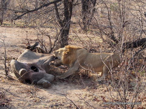 ot too far from where we made our provisioning stop, we parked the bikes at an accommodating hotel at the edges of the private reserves and were transported into the reserve area and onto our lodge by vehicle. Apart from the more obvious risks of riding a motorbike through wild animal country, it would have been a very technical ride (‘technical’ is an often used euphemism in motorbike-speak for extremely difficult requiring a high level of specific skills!). It was quite a rough, tricky track for the last several kilometres to the lodge.
The lodge was quite something: eight separate bungalow/apartments, strategically placed in relative seclusion from one another over an area of a couple of hectares. This area is bounded by an electric fence with an electrified grill as an entry grid. A central building has dining, kitchen, lounge and recreation facilities, including the compulsory (in South Africa) boma with braai (a BBQ within a “protecting fence” of logs).
 We arrived in time for an evening safari drive into the reserve area in open nine seater 4x4 Land Rover busses of sorts. Animal spotting on safari runs like this is a ‘chance it’ business. It’s always on the cards that one might not see much beyond an impala or two. Well, our fortunes turned out better. Over the day and a half we were there and over three safari runs into the reserve, we managed to see more than we might have reasonable hoped for. In fact on the first run alone we covered four of the “big five”. The big five are lion, elephant, rhino, buffalo and leopard. We didn’t see any buffalo.
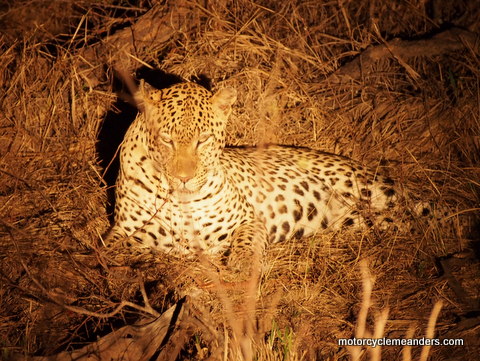
The jewel in the crown was the leopard, certainly the most elusive of the big five and probably of the greater Kruger population. The rangers knew it was in the area because of a discovery of a warthog carcass in a tree. It was only on our return after drinks in the wilderness – by then pitch dark that we headed off the track, such as it was, and bush-bashed through scrub that the leopard was spotted in the beam of a strong flash light. We manoeuvred close to where it was secreting itself in bushes. Quite a sight.
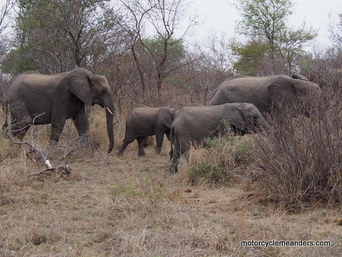
On a following safari run early next morning we met several zebra, elephants in a herd, more lions, including a pair engaging in the long drawn-out mating procedures. Our third safari run that evening came across another rare sight: several lions taking it in turns to finish off a Rhino calf they had evidently killed a couple of days prior (judging from the obnoxious smell and the effort of the lions to get the last bits from within the carcass). Meanwhile hyenas and vultures patiently waited and watched, ever ready to move in once the lions had been satiated.
Baobab Ridge to Long Tom Pass
 The one and a half days at the game reserve had been so successful in terms of sights and so enjoyable, we’d almost forgotten that we were on a motorcycle tour. Not only were there three safari runs with rare sightings, but a couple of “braais in the boma.” But it was time to move on.
The essence of today’s ride was to head west back over the Drakensberg onto the high veld before travelling south and then heading east to cross the Drakensberg again, but overnighting just over the summit on the eastern side. This involved a strategically planned circuitous route to get us to our planned destination taking in two of the more spectacular Drakensberg passes: Robbers’ Pass and Long Tom Pass.
I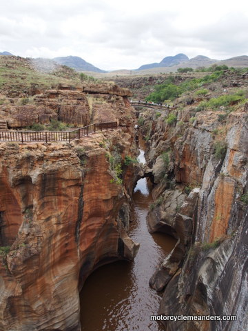 t wasn’t long out of the Klaserie Game Reserve before we had ridden across low veld plains to the beginning of the Drakensberg. The first climb was a steep and twisting ride along high walls of granite onto a plateau that stretched and undulated for several kilometres forming a cradle within the folds of peaks and troughs that constitute the body of the Drakensberg. It would still be some time before we made the final climb over the spinal ridge before dropping down onto the high veld.
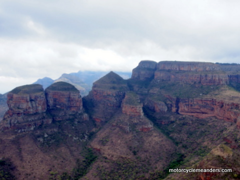
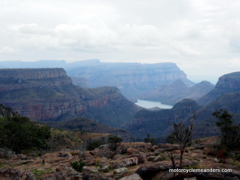 During this “cradle phase” we made a few short diversions to visit some of the topographical marvels such as the Rondwels (a sort of gigantic Three Sisters) and Bourkes Luck Potholes (a small canyon with steep walls forming a series of cauldrons). These features were part of the much larger Blyde River canyon – reputed to be the largest “green canyon” in the world, being covered with subtropical foliage.
 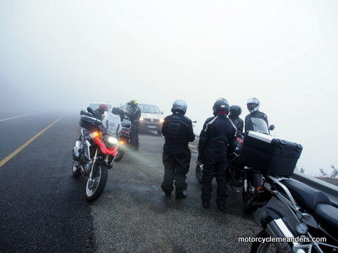 Then came the final stage of climbing out of the cradle to cross over to the high veld by way of Robbers’ Pass. More enjoyable riding through turns and scenery. After a relatively short run through a couple of towns on the high veld, we began the climb up Long Tom Pass. We cast aside the need to keep more of less in a group as our destination was near the top of the pass, so it was a brisk ‘free ride’ through the evenly twisting turns to about three quarters of the way up before running into thick fog that barely disclosed the bike in front with tail and hazard lights blazing.
The accommodation was called “Misty Mountain” and with good reason. The plan was to have a full day of riding the famed “Panorama Route” before returning to Misty Mountain for a second night. That was thwarted by fog and rain, so we substituted a four wheel ride to some of the key sights we had planned to visit. The best were fog bound but some others were low enough to allow visibility.
Long Tom Pass to Mlilwane Sanctuary, Swaziland
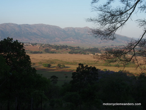
 Misty Mountain was equally misty the second morning. By the time we were ready to leave, however, it had cleared at the hotel and surrounding valleys. That meant a sunny start to descend Long Tom Pass – but not avoiding thick patches of fog at various sections of the descent.
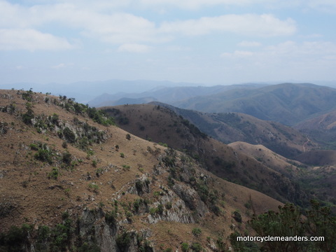
It wasn’t a long ride across the low veld before being confronted by the Makhonjwa Mountains to weave our way up and into. The twisting road had many vantage points from which to be amazed at the exposed rock formations, the rolling hills and distant peaks. We were, in fact, riding along a “geotrail” – the Barberton Greenstone Belt. The rocks in the area included a huge variety of different types and are some of the oldest well-preserved rocks on Earth, dating back some three billion years.
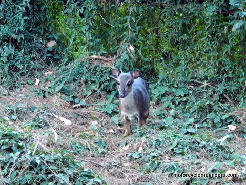 It was in the folds of these mountains that we crossed into the Kingdom of Swaziland, nestled high in the plateaus and dips of the range. The border crossing was quick and efficient; and then a roll into a different world. The first twenty kilometres beyond the border post was a challenging gravel road with steep gradients to add to the rocky and loose surface.
The bitumen roads were in quite good order as we passed through several dusty villages. The houses seemed humble but the school children were all neatly attired in their uniforms. Our destination was the Mlilwane Wildlife Sanctuary. We had special permission to ride through the park to reach our hill top lodge (no big game animals; mostly smaller vegetarians). The setting had a history from colonial times and the main lodge building must have been a stand-out colonial home of massive proportions for its day. The evening was climaxed by the traditional laager of seating round the fire while enjoying another typical South African braai.
Mlilwani Sanctuary to Rorke’s Drift
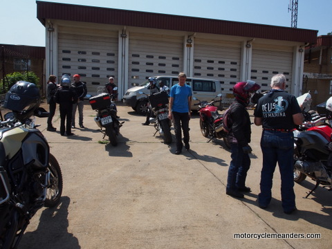 It was supposed to be an easy ride through Swaziland before crossing back into South Africa in southern Swaziland. Somehow our corner marking system had a short; and soon we realised that David and Lesley in the lead vehicle were nowhere to be seen. Fortunately, we on the bikes (there were eight bikes at this stage) stayed together. After much consulting of
 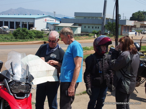 maps and committee-like discussion, we managed to get ourselves totally confused as to where we were and where we should be. We couldn’t even successfully follow a kind fire brigade officer who had offered to lead us out of our confusion to a direct road to the border crossing. It all had a happy ending. We found the border crossing and David and Lesley, who, on realising we were irreparably separated, opted to go to the border crossing on the assumption that we also would opt to do likewise.
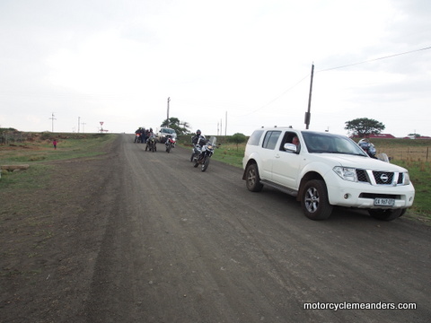 We were then soon into Zululand. In today’s arrangements it’s the province of KwaZulu Natal. But in times past this was the hub of the Zulu Empire. We had planned a stop at the Voortrekker monument at the site of the Voortrekker victory over the Zulu at Blood River. Unfortunately, the minor and poorly marked roads had us some 30km past where we should have been. We wisely (as it would turn out) decided to push on to Rorke’s Drift. We had a long trek along gravel roads before getting there as lightning was intermittingly flashing across the sky and large drops of rain were softly falling. I assumed that so long as I could still see dust spraying from the back tyre of the bike in front, the rain was of no consequence.
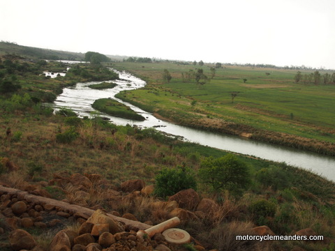 We arrived at our hotel, situated only a couple of hundred metres further along the Buffalo River from the site of the original Rorke’s Drift (a ‘drift’ is a ford in our speak: a place where the river banks had been cut away for access and the bottom of the river was passable by the oxen wagons). Rorke’s Drift (the name was also used for the small trading and mission station 600m or so from the drift itself) was the site of a much vaunted successful defence by a hundred or so British military and colonial militia against some thousands of Zulu warriors. The movie Zulu (Michael Cain’s very first movie) was all about this event. So there we were standing on the balcony of the hotel looking across the Buffalo River into Zululand just down from the drift and wondering what the next day would bring as we toured the battlefields.
Oh, and…within about twenty minutes of arriving, we were entertained by the most thunderous and strobe-lighting storm followed by a torrential downpour the likes of which would have made our ride in very challenging.
Rorke’s Drift
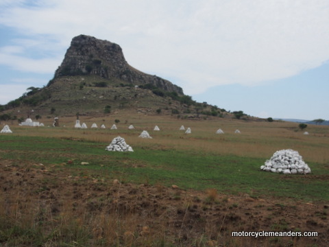 We spent the morning touring the two battlefields here that were part of the Anglo-Zulu wars. They came about as part of the British imperial agenda to have control over what would become South Africa.
T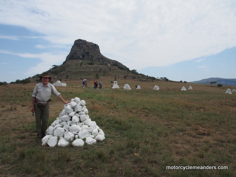 he wars started with a British invasion of Zululand at Rorke’s Drift. The column of British forces proceeded on the first day of the invasion to, in their view, a perfect camp site at the base of a Sphinx-like hill called Isandlwana. If you’re really keen you can read lots about it here. In short, through a combination of being out-manoeuvred by the Zulu and exhibiting an unusual display of military ineptitude, Isandlwana became the biggest defeat of a British army by an indigenous force. While the main part of the British force were being led astray by Zulu decoys, the Zulu overran the camp and slaughtered those defending it.
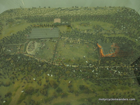
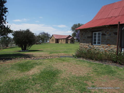 Later the same day, late in the afternoon, a contingent of Zulu forces crossed the Buffalo River into Natal and attacked the British garrison at the small mission outpost at Rorke’s Drift. The garrison had little warning, but hastily erected some barricades around the two buildings they had requisitioned from the mission. The outcome was that just over 150 British and colonial troops held off some 4000 Zulu through over 10 hours of fierce fighting, much of it hand to hand. Eleven Victoria Crosses were handed out to the defenders.
 The original buildings were destroyed but replacements were subsequently built in the same places so the layout of the Rorke’s Drift mission statement looks similar to how it would have looked at the time of the battle.
We had a very engaging guide who brought to life the details of both battles. It was quite an experience to be there and “see” events unfold in the very places where they happened.
An afternoon ride brought us to Nottingham Road (the name of the town) for the night.
Nottingham Road to Sani Pass, Lesotho
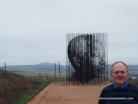 While Sani Pass was very much our focus, there was one important stop before we got there: the Mandela Nelson Capture Site (and memorial). This commemorates the life and achievements of Mandela highlighting the event that took place on the road in front of the memorial. Nelson Mandela had been a wanted man for several years as an organiser of resistance against the apartheid regime. Eventually he was captured when a car full of apartheid police pulled over a vehicle with Mandela in it. This was the beginning of his 27 years of imprisonment. The feature of the site is a sculpture that from a distance looks like a random grouping of upright black iron posts. As you move to a certain perspective, the image of Mandela appears. Quite surreal.
 Then it was on to Underberg, a small town sitting at the approaches to the Drakensberg. Thelma, one of our South African members, has a sister there who runs a B & B. That became our base to launch onto Sani Pass.
It was another international border crossing today, this time into Lesotho, nestled in the high plateaus of the Drakensberg Mountains. The route into Lesotho is Sani Pass, a formidable pass with a fearsome reputation. The owner of the hotel in Nottingham Road, in trying to be encouraging, succeeded in putting the fear of God into some of us, including me. We might have still retained our resolve were it not for the bleak and damp weather. Ray, who had just completed a ride from London to Magadan on Russia’s east coast, and Greg, an accomplished off-road rider, were not to be deterred.
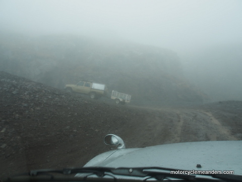
So the team set off: two on bikes and the rest in 4x4 that the Sani Hotel had arranged. We had been told by many that the first 20km or so to the South African border post was fine; and it was only the final 7km to the top that was the worry. Well, we would-be or would-have-been riders didn’t share that assessment as we bumped our way along the wet, rocky and slippery-looking track to the South African border post.
We learned there that Ray and Greg were already ensconced in the hotel bar at the top of the pass.
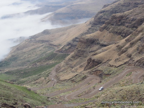
 The final section, the greatest part of the climb, more than confirmed the wisdom of being in the 4x4s. The final section is notorious because of its 9 very tight and frighteningly steep switch-backs that land you on an incongruously flat plain that’s Lesotho. The Lesotho border post was no more than a beat-up old caravan that had obviously taken a roll – probably on its way up the pass years ago.
The hotel boasts being the highest pub in Africa at 2,784m (that’s about 500m or so higher that the absolute highest point in Australia). The view is supposedly spectacular, but all we could see was fog, thick fog. re was much re-telling of the experience of riding up by Ray and Greg as we enjoyed a warm evening in the cosy hotel before wandering in the dark to our dongas dotted on the nearby plains.
I learned later that the hotel is in South Africa but the dongas are in Lesotho!
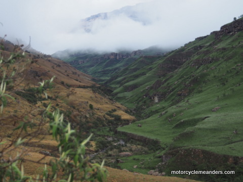
We woke to a fairly clear sky with patches of fog in the valley. It was a wonder-view of the pass creeping its way from the distant fog through the twists and turns to the top. On the way down in the 4x4s the road looked relatively benign in contrast to the day before. But not all that inviting. I had some regrets but only fleetingly until reality and common sense took hold again.
Golden Gate National Park
 Once down from Sani Pass, it was back to the B&B to collect the bikes and head out for Golden Gate National Park. We back-tracked for a while retracing our route from the previous day through low veld countryside that witnessed significant events of the Ango-Zulu wars and the Anglo-Boer wars. Our objective was to head back into the Drakensberg via Van Reenan’s Pass north of Sani Pass and north of Lesotho. This was the area of the Drakensberg that the Voortrekkers crossed when Piet Retief and his followers first ventured into the land of the Zulu – an event that triggered the tensions and animosity that led eventually to massacres of Voortrekkers, Zulus and British. Van Reenan’s Pass, however, post-dated the Voortrekkers and was a product of the Anglo-Boers.
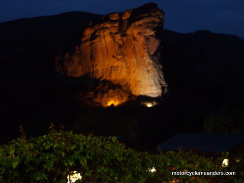 The ascent up Van Reenan’s Pass might have been spectacular – it’s reputed to be – but for us it was trying to keep an eye on the hazard lights of the bike ahead the fog was so thick and the rain, which had been with us most of the day, was still tagging along. As we rode over the lip of the pass onto the high plateau of the Drakensberg range, almost miraculously the sky cleared to reveal a vast vista of rolling high veld plains rimmed by sharp jagged peaks of rock. This was the cradle of the Drakensberg.
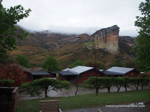
It wasn’t long before some light rain followed us into the Golden Gate National Park. This was an expanse of high veld country that was dotted with a variety of massive rock formations that seemed to change shape with every turn of the road as it wound its way through the park. The ride to the chalet was so good in terms of both scenery and motorcycling, there was a plan hatched to re-ride it next morning before continuing on our way. That got thwarted by a night of constantly teeming rain. Fortunately, by departure time the rain has retreated to a drizzle.
Lesotho (again)
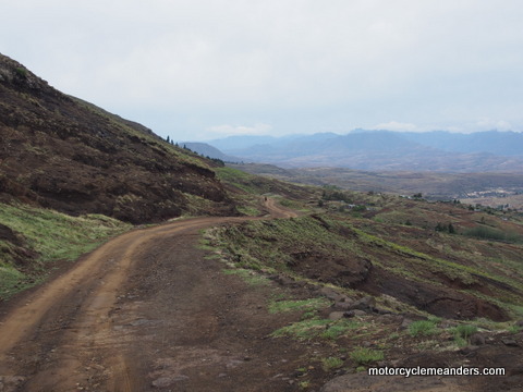 It was to be another foray into Lesotho today. The first one at the top of Sani Pass had us only a few metres into the country; but now we would enter at the northern end and pretty much run through the length of this tiny nation that’s an island within South Africa.
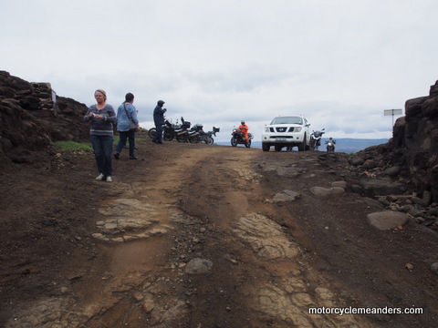 The rain eased as we headed through South Africa towards the border. The aftermath of the night’s rain was clearly evident in the mud and puddles along the side of the road. We knew we had some dirt riding today so were relieved to see less evidence of rain as we progressed into Lesotho.
The border crossing was relatively quick and efficient. The change of the surrounds once into Lesotho was stark. The settlements and their markets along the road were bustling but shabby compared to what we had so far seen in South Africa. Soon we turned off the main road to head for Malealea Lodge for our night’s accommodation. The road immediately deteriorated but was sort of bitumen with hard gravel stretches. n came full on dirt up to the “Gates of Paradise” Pass and down the other side to the lodge. It seemed that we were on top of the world out here. The views of mountains and valleys stretched almost to infinity.
Kareedal Farm
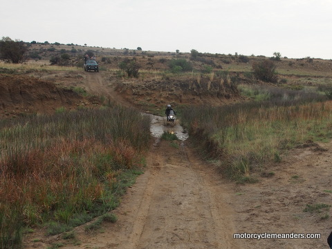 The day started excitingly – with no sense of just how “exciting” it would turn out to be by day’s end. The long stretch of dirt road from Malealea Lodge was a much longer and steeper climb to Gates of Paradise Pass than we experienced coming in. We were getting plenty of varied dirt riding; and this run provided some challenges. It was sort of a consolation prize for not having done Sani pass.
 We still had quite a bit of riding in Lesotho, including a couple of benign police checks along the way. They seemed more interested in our trip than our riding legitimacy. Once out of Lesotho, we were into the more open plains of the high veld heading for its southern perimeter – a vast less fertile area called the Great Karoo. But before we did that we took a small diversion across the Orange River into what today is the Free State Province of South Africa, but in its past housed the significant Boer republic of the Orange Free State.
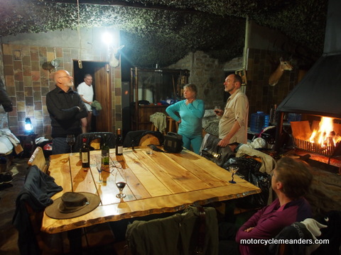
Our destination was Kareedal farm, an expanse of some 1,100 hectares that runs as a hunting lodge for mainly deer species, wildebeest and warthogs. The ride in was about 7km of none too smooth gravel road, including a wide section of uneven rock face. Some 10km from the main lodge is a small hunters’ hut perched high on a ridge and overlooking miles of undulating veld. A foreshadowed highlight for us was a bakkie ride to the hut for “sundowners”. (A “bakkie” is the South African version of a ute for us, although in this case the back had waist-high bars down each side.) Six of us could sleep in the hunters’ hut as a special treat. I was one of them.
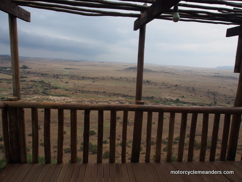 So it was all piled into the back of two bakkies, with the indomitable Greg riding up for the night. Sundowners were enjoyed with the mesmerising view of part of what had been fought over all those years past. A couple of stray giraffe and a herd of wildebeest could be seen in the distance ambling along the never-ending plains. We all went back down to the lodge for dinner before the six of us returned to the hut in the bakkies. About half way up, the rain started, got heavier and heavier before transforming itself into hail. By this time we were thoroughly drenched, squatting down to avoid the full force of the storm, with one hand desperately trying to stave off the hail from our heads and the other firmly on the rails as the bakkie bucked its way up the ridge. The only sounds that could be heard were the grinding of the complaining engine and our uncontrollable laughter. But worse was to come when we discovered several leaks in the thatched roof of the hut, some of them right over beds, making them unusable. We managed to move some beds to dry spots but had to abandon one of them. Getting priorities right, we got a fire started, opened a couple of bottles of soothing red wine; and then found some dry clothes.
It seemed a long night, followed by a long ride out from the lodge in persisting rain, with flowing drains and mud-lined puddles creating a very different road than the one we came in on the day before.
Graaff Reinet
 After a slow and precarious ride out of the farm in rain, mud and lots of water on a slippery dirt road, we headed back over the Orange River to continue our way south. Not far into the ride the countryside evolved into the Great Karoo. This is a large semi-desert tract that had been a formidable barrier for the Voortrekkers heading north to the more fertile high veld. The most notable characteristics of what we saw of the Great Karoo were the high ranges that criss-crossed expansive, dry and barren rolling plains.
 The small, sleepy town of Graaf Reinet, our lodgings for two nights, is the fourth oldest European town in the country. It was established in 1786 by the very early “Trekboers” predecessors of the Voortrekkers, who first started the push to get out from under colonial rule. It was one of two early-declared Boer republics set up while Holland and Britain were jostling for control over the Cape Colony. It didn’t last long as such.
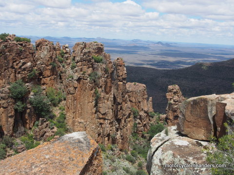
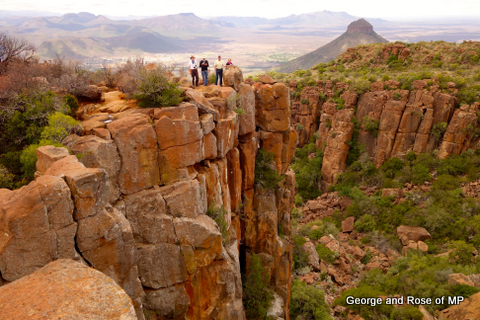
A day’s excursion was a ride to the “Valley of Desolation” a short distance south of the town. The valley has been described as a cathedral of mountains, with its high vertical peaks of seemingly precariously balanced rocks. It’s a stark illustration of the layered nature of rock formations created by banks of sand and clay over 200 million years ago. The high vantage points surrounding the valley provided views of Graaf Reinet as well as the valley itself.
Graaf Reinet to Storms River
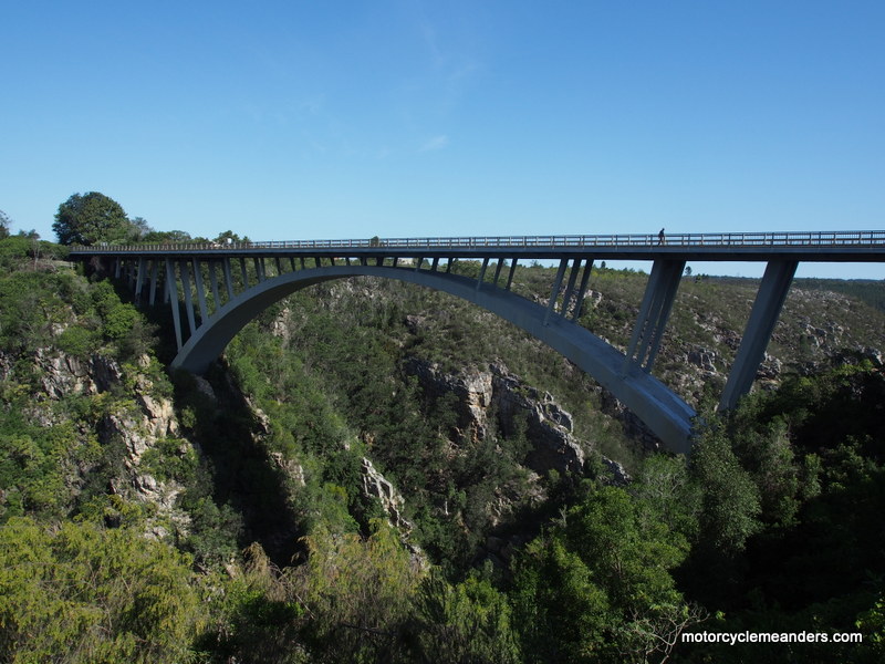 It was a long, brisk and mostly straight ride for the first part of the day from Graaf Reinet to our next destination of Storms River Mouth. We had a few hours of crossing the Great Karoo whose topography continued to be mildly rolling, fairly barren plains; stark mountains in the far distance; and ranges to climb and crossover as we traversed this unforgiving expanse. The speed limit is posted as 120kph; but the local customary limits seem to be 130-140kph.
 Towards the end of the Karoo, low, thick, green vegetation took over the terrain until the foothills of a mountain range totally blocked our path. We changed direction from south to east as we ran along the edges before a pass took us over the mountains onto the coastal strip: lush,
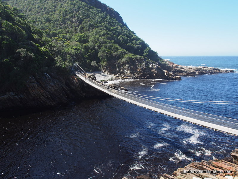
  thickly forested and sea-breezed. We were soon looking at the Indian Ocean along South Africa’s south coast. The dry heat of the Karoo was replaced by the pleasant chill of ocean winds. Along the southern foothills of the Tsitsikamma Mountains, as we rode west, several rivers, whose sources are in those mountains, have cut through deep ravines to their mouths along the coast. High, single-span (under the road) bridges have replaced what must have been tortuous roads to get down and back up these many ravines.
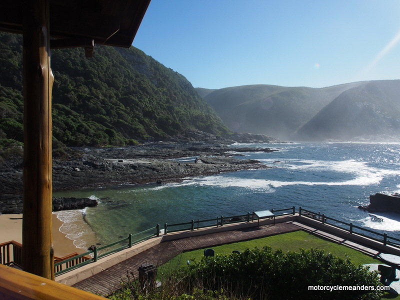
Our national park chalets at Storms River Mouth were perched on a headland overlooking the beach, sea and river mouth, with the rugged edges of the coastal cliffs fading long into the distance. A somewhat strenuous walk up and along a ridge overlooking the river led us to suspension bridges that facilitate access for the keen bush walkers.
- Next morning, it was riding further east over more ravines before changing direct into the Outeniekwa Mountains for a night’s stay in their southern foothills early into Robinson’s Pass.(There is a series of interlocking mountain ranges all along the hinterland of the south coast that get called different names every so many kms!)
Robinson’s Pass and Swartberg Pass
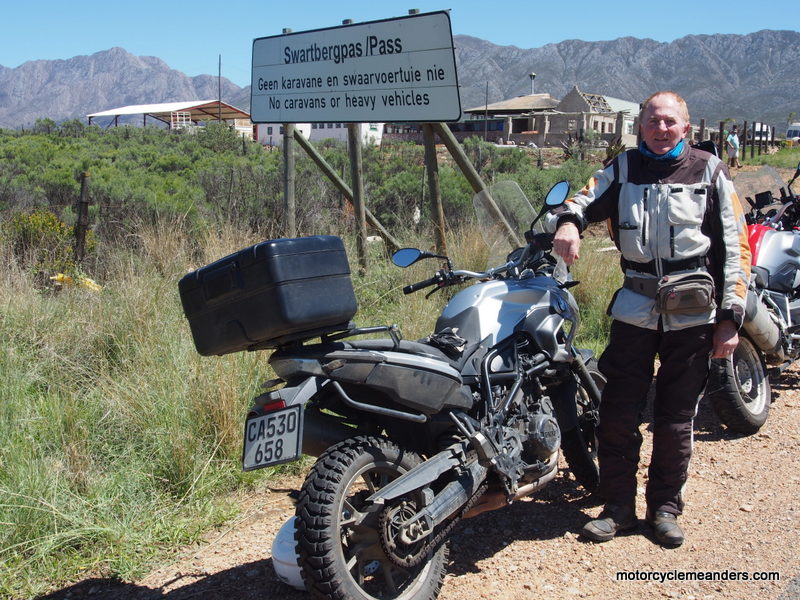 Today may well have been the best riding day of the tour. It started with Robinson’s Pass. We had stayed overnight at the foot of the pass. It connects Mossel Bay on the coast with Oudtshoorn over the Outeniqua Mountains in the Little Karoo. The pass is noted for its sweeping curves and superb views of rugged mountains and open valleys. Getting the curves in sync meant a most delightful run all the way to the top and over. The pass brought us down into the Little Karoo, with the Great Swartberg range clearly visible in the distance. We then crossed the relatively narrow Little Karoo before heading into the foothills of the Swartberg Range. Then came Schoemanspoort (a ‘poort’ is a narrow chasm). It provided tightly cornered feeder route to the fabulous Swartberg Pass.
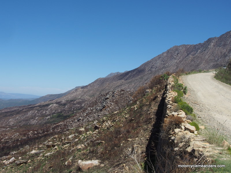 The pearl of the day was Swartberg Pass. It’s been described as the rubicon of gravel road passes. A website on South African mountain passes says “there is an allure and mystique around this old pass, coupled with its status as a national monument, which elevates this pass to the very top of the list.” It was all gravel! It had tight switchbacks, steep inclines, rough rocky surface in parts: challenging but not to the point where it became unenjoyable. Several vantage points provided amazing views of the range, the pass and the valleys of the Little Karoo.
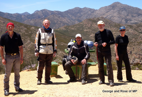 After lunching in the quaint, arty town of Prince Albert, we continued with a loop back to Oudtshoorn for our accommodation. But another gem still waited us. The Meiringspoort is described as a top 10 destination. This poort is incredible. Its wall are towering high, it’s very narrow for most of it, there are innumerable drifts (fords - but concreted) and a gushing waterfall along the way. It has a history of floods, landslides; and one can only marvel at the engineering feat of the roads construction.
It was a tiring but energising day to have accomplished so much and experienced such a variety of riding.
Oudtshoorn to Montagu
 By now, that awful “the end is near” feeling has started to take hold. Montagu will be our last stopover before we arrive in Cape Town.
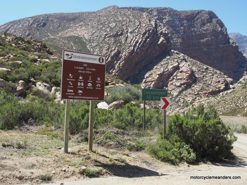
For a good part of the day we travelled the panoramic Route 62 which runs lengthwise through the Little Karoo. Three of us (the indomitable Ray and Greg, who did Sani Pass, and me) opted for a side trip through the Seweweekspoort. (The ‘poort’ part is a chasm; the rest is a more challenging way of saying “seven weeks”.)
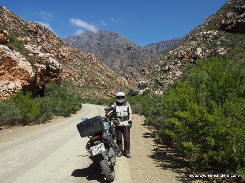
The “Seven Weeks Poort” is a gravel road that winds its way through a narrow chasm between high, jagged rock cliffs walls. It’s considered by many to be the most spectacular poort in the country. The trio’s joint view was that it outdid the Meiringspoort that we rode the day before. It was a case of riding about 17km through the chasm and then riding back through it again to re-join Route 62.
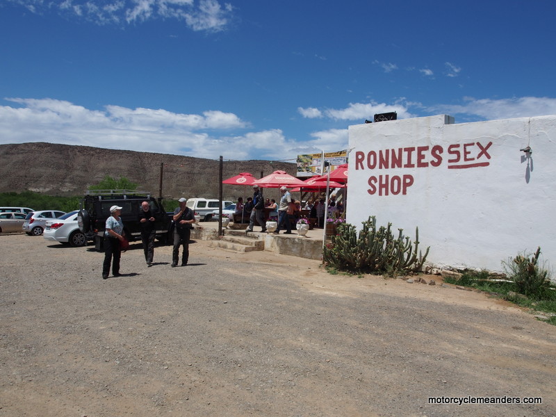
 The rest of the team had moved about 70km on for an extended rest stop at “Ronnie’s Sex Shop” – a stand-out establishment surrounded only by miles of the stark landscape of the Little Karoo. The story goes that it was called “Ronnie’s Shop” until he sold it. It had by then had such a name as a roadhouse that the new owner inserted an “ex” between Ronnie and Shop! Some wag then wrote in an S. Maybe the story is local mythology, but it works!
 A diversion from Route 62 took us up and over Tradouw Pass, another great ride of twists, climbs and descents, before we rode through the old town of Swellendam. That caught my attention. Swellendam and Graaf Reinet, where we were just a few days ago, were the two towns that became the first Boer republics, long before the Voortrekkers had set up the Orange Free State and the Transvaal. They were declared as such by the early settlers – the Trekboers. This happened in 1795, the year the British first occupied the colony in the aftermath of Holland being over-run by Napoleon. Their Independence didn’t last long. The new colonial occupiers saw to that! Their claim to fame on that basis seems to get overlooked.
Then the road to Montagu through the Cogmanskloof Pass, along which was a natural gateway of a rock arch on top of which are the remnants of a British fort from the second Anglo-Boer War (known to us as simply the Boer War). Montagu is snuggled between mountain ranges but supports an extensive wine-vine growing industry. Once again, a guest house that would compete with any 5 star resort.
Montagu to Cape Town
 Sadly, the last day of the ride to Cape Town arrived. However, we have four days in Cape Town that will include day rides.
We left Montagu after early morning rain that seemed to have cleared. So no wet weather gear. It wasn’t far into the ride before the rain started to persist. So a stop for wet weather gear. It wasn’t long after that that the rain dispersed for the rest of the day. Donning wet weather gear is supposed to be on the balance of probabilities. Strange that it seems the balance always tilts in one direction!
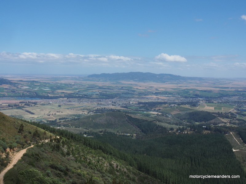
As is our wont, we made a couple of diversions to ride a passes that weren’t on the main roads. Du Toitskloof Pass provided an amazing vista of a fertile valley the likes of which we hadn’t seen throughout the tour. This was the Paarl Valley, renowned for its production of many of South Africa’s premium wines.
 Next was the Bainskloof Pass. This was a narrow road with a spectacular climb up the side of the range, but today was savaged by a fierce wind that almost stopped the bike in its tracks at every corner. The plan was to climb the pass and then return back down. In the circumstances, we called the climb off about two thirds of the way up.
We then entered an entirely different terrain as we passed through vast hectares of wheat growing areas and general farming. We were now north of Cape Town traversing the fertile lands that had immediately attracted the first colonial settlers and where they first came into contact with the indigenous Khoikhoi.
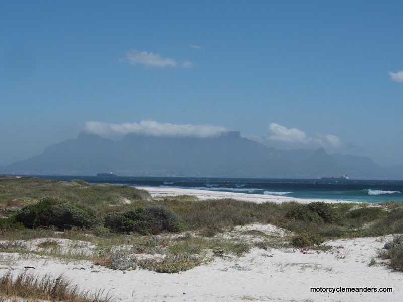
Later in the day, riding south along the Atlantic coast, Table Mountain began to grow larger in our view heralding the imminence of Cape Town. We circuited the city part of Cape Town and headed south on the peninsula that leads to the Cape of Good Hope. Along this route is a small township or suburb called St James. It’s noted for its mansions reflecting an era and life-style long past. Our “Villa St James” mansion echoes an opulent and high-society way of living and entertaining that has now become part of the history of the former colony.
We felt relieved that we completed some 5,000km over three weeks without a fall-off, dropped bike or any serious incident.
Personally, I feel very comforted at having done so much gravel/dirt riding (some optional) that has significantly increased both my breadth of experience and confidence.
Round Cape Town
 We kept the longest ride day (in terms of hours) for Cape Town. From our Villa near the top of the peninsular whose southern tip is the Cape of Good Hope, we set out north/north east along the shores of False Bay. The terrain varied from sea level beach fronts to coastal roads climbing up and over the rugged, high promontories that protruded
  into the Atlantic Ocean. Soon enough it was over another mountain Pass into the lush valleys that house the very first satellite settlements out of Cape Town itself. These were Stellenbosch, Paarl and Franshoek. Franshoek Pass brought us first to the town of Franshoek with its gleaming white buildings exhibiting the unique
designs of its long history. These valleys are now South Africa’s premier wine growing areas; and there are long-established wineries throughout the valleys. As a postscript, it was from these first settlements that the Trekboers, the predecessors of the later Great Trek, set out north and east to escape the Dutch East India Company’s restrictions on their freedom of trading and movement.
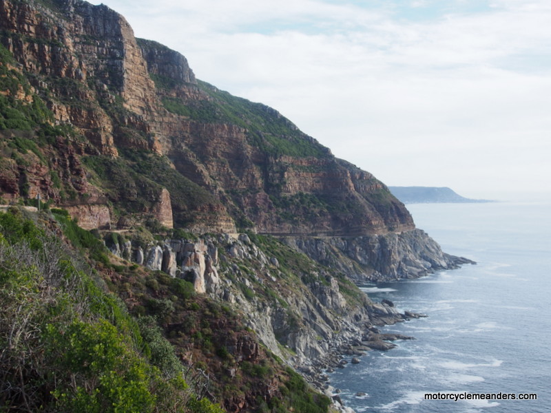
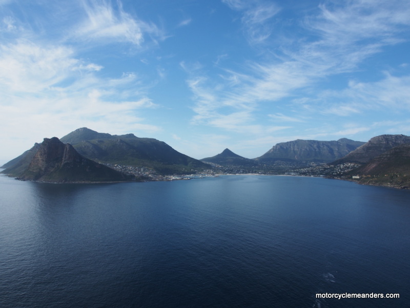
Some of us diverted on the ride back to Cape Town to ride the mountain-clinging road to Chapman’s Peak providing not only a great twisting ride but also a spectacular view of Hout Bay with the southern profile of Table Mountain forming the background.
Cape of Good Hope
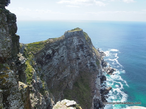
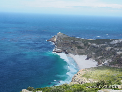
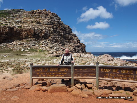 The lure of the cape! Between mythology (the Flying Dutchman) and history (from Bartholomeu Dias and Vasco da Gama), the Cape of Good Hope is a fable in itself. It’s essentially the tip of the peninsula that runs down the western side of the South African coast. There are, in fact, three promontories that one might loosely lump together as the fabled cape; but only one of them is officially the Cape of Good Hope. It’s the first one a seafarer would spot coming from the west. Far more spectacular is Cape Point which far more captivated the imagination and consternation of the early seafarers.
 It was a Portuguese seafarer Dias in 1479 that sailed further down the west coast of Africa than anyone else had recorded. Battling stormy conditions he “discovered” the bottom of the African continent and confirmed that the coast line then trended northeast. The way round Africa was established. He called the cape the Cape of Storms: but King John II of Portugal realising the implications of finding a p
 assage to India, called it the Cape of Good Hope. I suspect at this stage the various promontories had not been distinguished from one another. The “cape” was simply the end of the peninsula that was considered the bottom of Africa. While it’s the most south western point of the continent, it’s not the most southerly. Vasco da Gama followed soon after and established the trading route with India and founded a Portuguese settlement in Southern India.
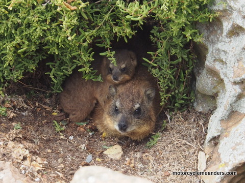 Three of us (two bikes) set out to ride the cape. It was a very scenic ride along the eastern edge of the peninsula, with the road winding its way into and over the coastal ranges before coming across an expansive plateau leading to the peninsula’s end point: the cape. Cape Point is a high, narrow rocky strip that juts into the sea providing a panoramic view of both sides of the peninsula. On its eastern side, the view extends north to the start of the peninsula and the coast of False Bay stretching further east.
While the actual Cape of Good Hope may be less scenically dramatic, it still had the principal lure. A compulsory photo stop!
Special Events
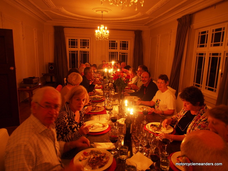 Our five days at the Villa St James provided opportunity for extra socialising. Our tour organisers, David and Lesley, ‘christened’ as Vink & Vink Inc, invited some local friends from times past. We had a dinner party for 24 – and a dining room and table to easily cope, such is the grandeur of the mansio. Norm and Diane, who rode with us for part of the tour presented each of us with a tin mug with name and tour embossed onto them. The tin mug has more symbolism that one might think. It’s a continuing tradition in South Africa that combines memories of the early trekkers and captures a contemporary way of life in the local settlements. Thanks Norm and Diane.
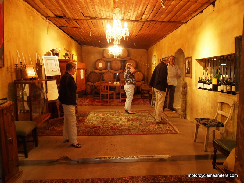
 One of these days was devoted to the god Dionysus. We had a very comfortable 14 seater mini-coach take us on a winery tour. The vast majority of South Africa’s wines – and they are highly regarded – come from lush, fertile valleys centred on the nearby towns of Stellenbosch, Franschoek and Paarl. These are the first settlements set up by the colonists after Cape Town itself. They date back to 1678-1688; and the first wineries followed soon after. The wineries are referred to as farms. One of the farms recorded its beginning in 1699. Many of its buildings and wine storage tanks (no stainless steel) seem to have come from not long after that.
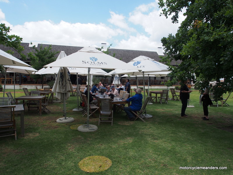
Apart from sessions of wine-tasting at a couple of long-established farms, we were treated to a great lunch with, of course, more wine. We learned a lot about the intricacies of or grape-growing to vary alcohol content, management of wine tastes and alcohol content and wine-making generally.
The day finished with dinner at the nearby Brass Bell at Kalk Bay. The restaurant sits right on the water’s edge and has a bar door onto the railway station.
Last Day
The last riding day inevitably turned up. Our sole remaining task was to deliver the bikes to the hiring company depot in downtown Cape Town, located fortuitously right beside the waterside precinct that is the main tourist and city attraction. We had two choices to get there: straight north along the motorway or south before crossing the coastal mountains and winding our way back north along the cliff faces. It wasn’t a difficult decision and a rewarding final 50km of riding.
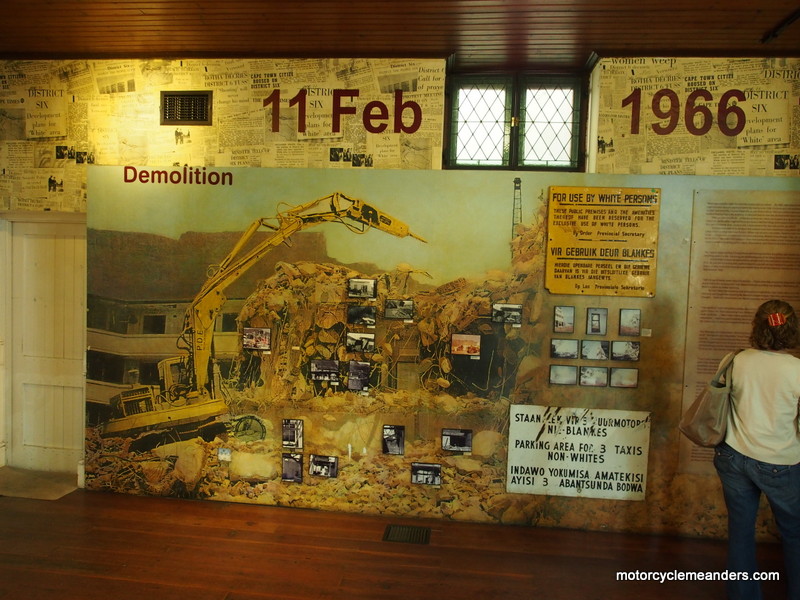 Then it was exploration of the waterside precinct – a marvel of upmarket shopping – followed by lunch with Paul and Viki. My aim was to visit “District 6” or, at least, a museum of the same name that presents the story of District 6; and in doing so lays bare much of the tragedy of apartheid. What came to be called District 6 was, in the 18th century, some farm land just beyond the outer limits of the Cape Town settlement. Over years it grew with squatters, then houses and streets etc. Its inhabitants were an eclectic mix of peoples of most races. Despite being sorely neglected by governments, especially under apartheid, it developed a unique identity and vibrancy. It was house, home and workplace to hundreds of people. Until 1966. That’s when the apartheid regime rezoned District 6 for whites only, forcibly moving the inhabitants further out to the Cape plains and demolishing much of their hard-earned and cherished housing, community places and work places. The museum highlights the stories of many individuals and families who could trace their ancestry and land titles back several generations of living and owning in District 6; and who were simply thrown out with no compensation and no immediate means of living. Post-apartheid and after much lobbying by former residents, some restitution has been made and some have been able to return.
It was only some hours later on the train back to our digs at St James that I pondered on the links between the story of District 6 and the recent movie “District 9.” The satire on apartheid had always been evident in the movie but the parallels with District 6 had eluded me; but they have now become so obvious; and added a new dimension to the movie.
Epilogue
It’s been a great tour: the Vink & Vink South Africa Tour 2014.
It has been a tour with everything: top class accommodation in uniquely South African villas, guest houses and B&Bs; BMW motorbikes well suited to the tasks demanded of them; spectacular scenery of high-peaked mountains, wide expansive plains, rugged coastlines, white-sanded beaches, lush forests and ancient wineries of top order; exposure to a history that exhibits the best and worst of human endeavours and responses – admirable, tragic, absorbing, fascinating; a mix of riding unimaginable of tightly winding mountain passes and “poorts” (chasms), sweeping turns across and through more open terrain, dirt and gravel roads of varying conditions and terrain in a mix of weather; and a productive safari beyond expectation that included some specials that most visitors would not get to see: a leopard, lions mating, several lions devouring a rhino calf they had recently caught and large herds of elephant with babies in tow.
As the finale came upon us, my mind was taken back to the closing ceremony of the 2000 Sydney Olympics, when not only the crowd in attendance but the whole country waited for (IOC president) Samaranch to declare them “the best Olympic Games ever.'' I think we all mentally echoed Samaranch’s sentiment as we appraised the Vink & Vink Inc South Africa Tour 2014.
A Few Movie Clips
Here are a few short video clips from the tour:
Swartberg Pass
Seweweekspoort
A Couple of Dirt Days
Klaserie Safari
Photo Albums
I have prepared two photo albums on the tour. The first is a generic one of photos covering the whole tour. The second is a smaller selection of photos from our three safari ventures at Klaserie Private Nature Reserve. After clicking on the arrow, select full screen.
Photo Album of Tour:
Here is the photo album of the tour
Photo Album of Klaserie Safari:
Here is the photo album of the Klaserie Safari
Return to Top of Page Go to Meanders Abroad
