 |
|
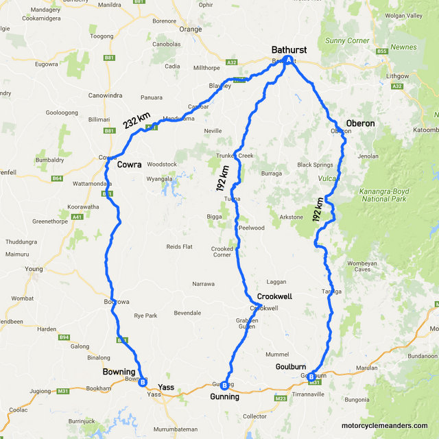
Traversing the Tablelands NSW: Between Bathurst and Crookwell March 2018 A ďNewĒ Road to Ride Another great motorcycling road in across the central and southern tablelands has recently been opened to the bitumen-only motorcyclists. This is the road between Bathurst and Crookwell. Iíve been watching the gravel section diminish from about 40 km c. 2008 to 3 km in 2017 to an uninterrupted tarmac runway earlier in 2018. On a practical level, continuing to Gunning, it provides a third option for transiting between the central and southern tablelands Ė the other options being Bathurst/Goulburn via Oberon and Bathurst/Bowning or Yass via Cowra. At 192 km, itís equal with the Oberon option as the shortest route to the Hume Hwy; but overall shortest between Bathurst and Canberra by some 20 km, losing out to the Oberon route by 4 km if the south coast of NSW is your starting or ending point. A Bathurst Start
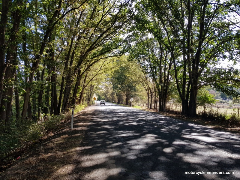
Itís a straight-forward run out of Bathurst passing several signs enticing you to divert to the near-by Mount Panorama Circuit. Thatís a very easy option whether youíre leaving Bathurst or arriving there. And it can be a lot more than a look/see. When not being used as a race track imprisoning the many households for whom itís the only road access to and from their properties, itís a public road for anyone to use. Not surprisingly, thereís a town speed limit of 60 kph, which is ample for the uninitiated coming anti-clockwise (the race direction) down the Esses from Skyline at the top of the track. Thereís also the National Motor Racing Museum as you exit the southern end of the circuit thatís worth a visit. Assuming youíre then on your way out of Bathurst, the road moves slowly through a few tiny edge-of-town settlements enjoying stretches of overhanging trees before heading to open farm country. Keep following the signs to Goulburn as Crookwell doesnít get too many mentions in the road signage. In contrast to the expansive and flat plains west of Bathurst, the countryside to the south is at times deeply undulating soon into the ride, providing enjoyable if gentle climbs, dips and inevitable turns to keep you well-focussed. Sights Along the Way
Itís always a thoughtful experience to amble through such a town and wonder about its halcyon days. Several weeks previously, on a dayís ride doing some nearby forest roads, we emerged just north of Trunkey Creek and stopped at the pub there for lunch. The choice was a pie or a sausage roll. But the hospitality of the proprietor and her good humour more than made up for the sparsity of choices.
The climb up the southern side of the valley provides a starkly contrasting experience. The first part of the climb is steep and sharply turned. The road finds paths between thickly wooded rises so that you feel itís like a railway line winding up the valleys and across the plateaus side-stepping the worst of the rugged countryside.
Once past Tuena, the countryside opens out again as the road Ė still winding gently Ė makes its way through more farmland. But the thereís still plenty of good riding as spurs of ranges dog its way forward, forcing it to manoeuvre alongside and up into wooded hills at times. Itís a continuing delightful romp all the way into Crookwell.
With the Noah-like flood of dual purpose bikes into the market, weíre all sometimes lured into the dare of a bit of gravel. So donít be put off by the all-bitumen attraction of the Bathurst/Crookwell road. There are opportunities to mix and match. Coming from Bathurst, about 29 km after a major T junction where you turn onto Trunkey Road (about 15 km out of town), thereís a left turn onto Old Trunk Road. I havenít ridden it but it looks like an easy gravel 5 km anabranch that takes you through farm country before re-joining Trunkey Road. If you look on Google maps in satellite mode, there are a few other seemingly more exciting options but Iíve no idea how exciting they might be. After Crookwell
The option that continues with our journey to the Hume Hwy is a turn-off to the right (south) before you get into town (or to the left as you return from town in the direction whence you came). That takes you along a top turning road of 44 km to Gunning: a truly great ride in itself. From there, itís a straight-forward run to Canberra or the south coast or Melbourne or wherever. If youíre simply cruising and looking for options, there are others you can take from Crookwell. One is to head to Taralga (all sealed) and do a return loop to Bathurst via Oberon. That might be excessively decadent: simply too much pleasure in one day. Thereís an enjoyable road to Goulburn from Crookwell. That, of course, is the ultimate destination of the road out of Bathurst; hence, the signs all saying to Goulburn. Thereís another (all sealed) enjoyable road to Boorowa from where you can double back through Cowra, head to Young to pick up the Olympic Highway or cut across to the Hume Highway. This is one of those times and places when the riding world is your oyster! |
 Although Iíve ridden the road both ways, my most recent encounter with it was north to south starting in Bathurst Ė and my first on the all-bitumen version.
.jpg?3) Bathurst is situated some 700 m above sea level so itís not that noticeable a climb across the farming country as the road rises to some 1,000 m over the55 km to Trunkey Creek. Thereís not much at Trunkey Creek: a few derelict buildings, a pub and only a handful of people who call it home; but in the 1851 gold rush days, started by discoveries made by Edward Hargraves, after his less successful ventures in California, the town is said to have housed some 2,500 people. Iím told you can still do some recreational prospecting in the local rivers if thatís your fancy.
Bathurst is situated some 700 m above sea level so itís not that noticeable a climb across the farming country as the road rises to some 1,000 m over the55 km to Trunkey Creek. Thereís not much at Trunkey Creek: a few derelict buildings, a pub and only a handful of people who call it home; but in the 1851 gold rush days, started by discoveries made by Edward Hargraves, after his less successful ventures in California, the town is said to have housed some 2,500 people. Iím told you can still do some recreational prospecting in the local rivers if thatís your fancy.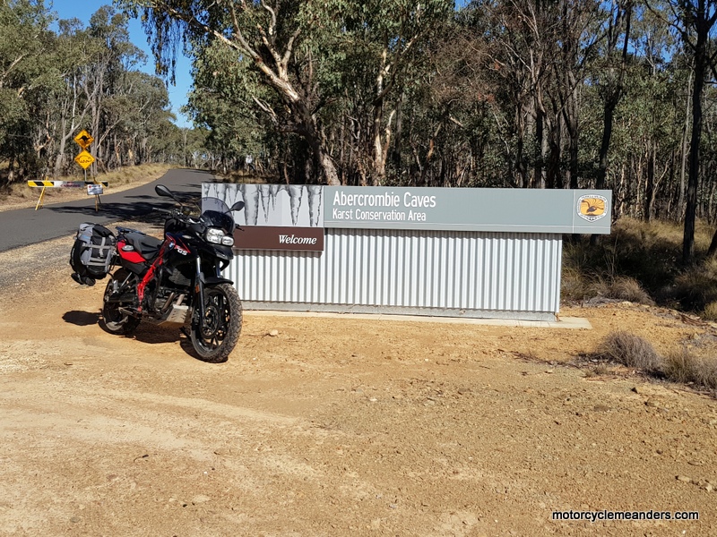
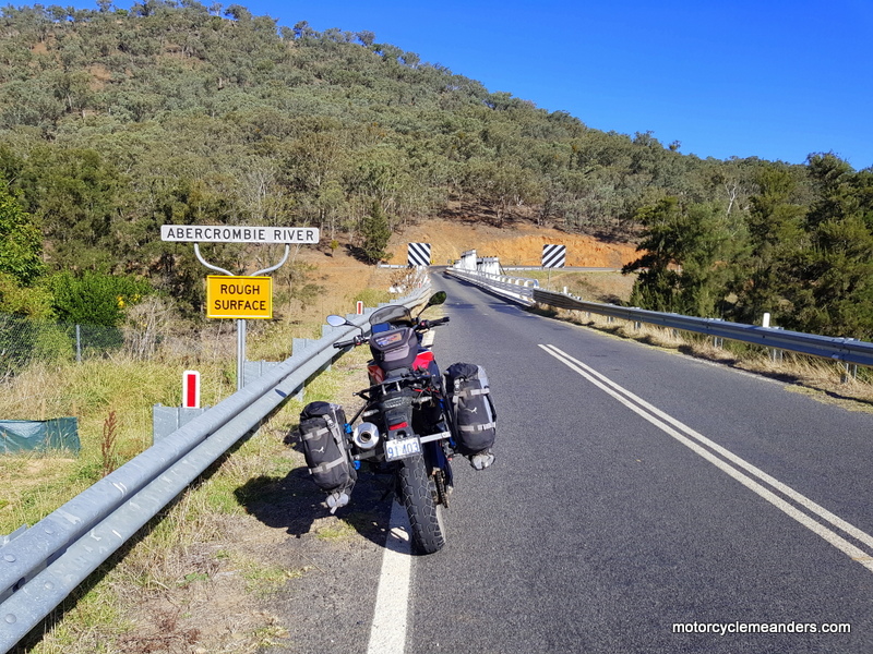 After the caves, the road continues to descend through mostly fast sweeping bends until it flattens out to cross the river at about 440 m. The warning of a rough surface on the river signage I assumed referred to the road rather than the river, but it could have been warning of both.
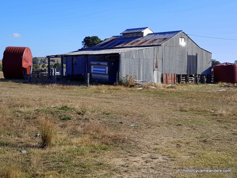 In the midst of this process the small village of Tuena pops up. Itís another 1851 gold rush settlement that grew to house a post office and police station, three pubs, a general store, a courthouse and a school; and several churches. Thatís a far cry from Tuena today. The old inn has seen better days. It sits lonely and forlorn as you come into town, not having seen a customer or a guest for as long as it can remember. Beside it is a small war memorial in honour of some thirty locals who responded to the call for the first world war and three for the second world war, reflecting the relativities of population between the early aftermath years of the gold rush and the set-in decline by the time of the second world war. And, as one invariably finds with such small-locality memorials, thereís always several sets of names from the same families.
 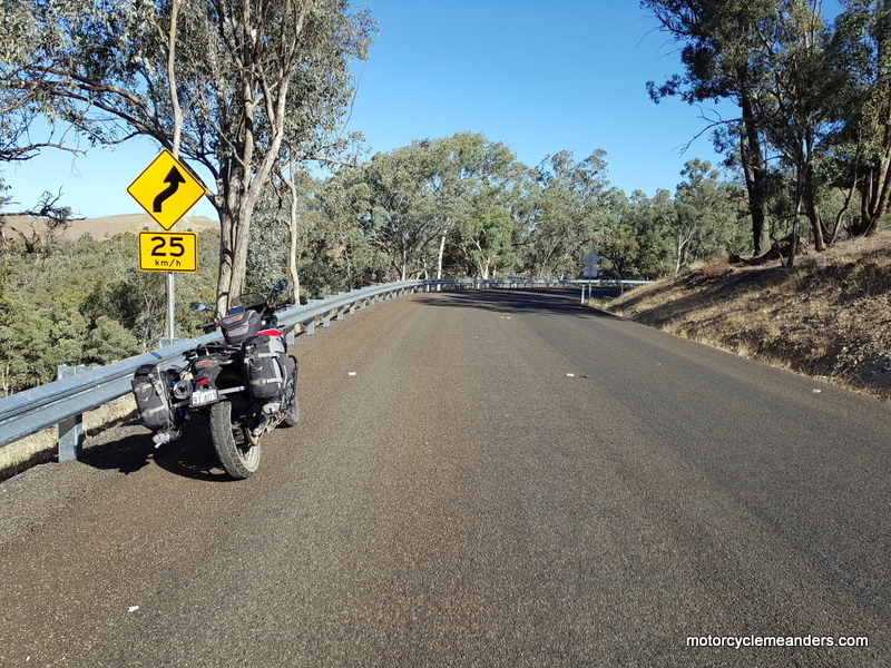 The main bitumen road takes you right into the relatively busy town of Crookwell. Itís one of those country towns that always seems to have lots of vehicles and people, hopefully reflecting local prosperity.