 |
|
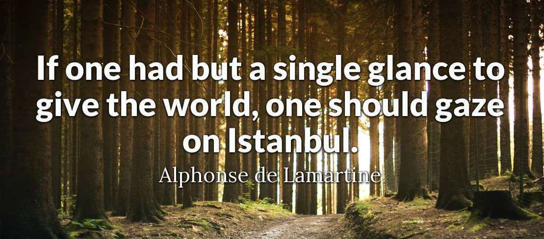
April-May 2008 Alphonse de Lamaritine was a French poet and politician Its hard to encapsulate the mystique and fascination of Turkey in a few words without resorting to some pretty tired clichés, such as cradle of civilization and crossroads of cultures. My starting point was a reasonable awareness of its role in the early spread and development of Christianity; a vague knowledge of a few ancient civilisations that had a foot there at one time or another; some appreciation of its contribution to our ANZAC legacy; and a limited awareness of its Islamic heritage.
The first was spending a few days in Jordan. That was a treat; and laid some markers for Turkey. What is now Jordan was all part of the Baghdad Caliphate, with which early Turk tribes developed close to the point of controlling relationships, that, in turn lead to the rise of Islam in Turkey. Jordan was also part of the Ottoman Empire and still has vestiges of that period in its only rail line. It shares with Turkey the best preserved Roman ruins outside Italy, which I visited before seeing Ephesus. And it has spectacular evidence of its role in the Crusades, most of which passed through Turkey, with the magnificent Kerak Castle. The second was additional time I spent alone in Istanbul, both before and after the organised motorcycle tour. It was a very special experience to get a better knowledge of and feel for so many aspects of such a fantastic city. The third was the motorcycle part of the tour with Ferris Wheels when so much of what Turkey has to offer came to light. Heres something that I had undoubtedly read and heard of before but had no really clear appreciation of until I could see and, as it were, touch it, namely, the East/West divide within Turkey. Turkey straddles two continents: the Asian continent in its East and the European continent in its West. It gets more interesting. Istanbul alone straddles both continents. Part of the city is in Europe and part of it is in Asia. Little wonder they talk about crossroads of cultures. E
Where the Bosphorus divides Istanbul, there is a spur of water that runs west into the European part of Istanbul. Its called The Golden Horn. It was once a beautiful inland water retreat (perhaps a bit like Pittwater or the lower reaches of the Hawkesbury in Sydney), but has become polluted with the citys population growth. In the past, it played important historical roles as a secure harbour and northern defence of old Constantinople (a former name of Istanbul). It still has some gems to visit along its shores The Dardanelles (formerly called Hellespont) is 61 km long and ranges in width from 1.2 km to 6 km. It continues the divide between the European continent (the Gallipoli Peninsula at this part of the divide) and the Asian continent (Anatolia). The narrowest part The Narrows is at the port town of Çanakkale (ç is a ch so Chan-ak-alay). It was here that the Persian King Xerxes built his bridge of boats to land 100,000 troops in Thrace. It was here also that Turkish forces, in March of 1915, scuttled the Allies naval attempts to control the strategically significant strait. This event, in turn, lead to the Allied decision to invade the Gallipoli Peninsula from the west as an alternative way of gaining control of the strait. The Turks commemorate the Battle of Çanakkale. We commemorate the Gallipoli Campaign. The Turks won both. We lost both. But, hey, who's counting? Istanbul
Close by is the Topkapi Palace, which became the control centre for the far-flung Ottoman Empire when Süleyman the Magnificent (great name!) consolidated the seat of the Ottoman Empire and his royal residence. (The ü is ew as in few.) The palace and its grounds are enormous. Its lay-out and architecture are both confusing and fascinating. Its history is thoroughly intriguing. Its a long walk to the Süleymaniye Mosque, but well worth it. Its the second biggest mosque in Istanbul. It was built by a famous architect, Sinan, for, not surprisingly, Süleyman the Magnificent. Unfortunately, it was closed for renovations, so I had to content myself with the surrounds. They were sufficient to make the walk rewarding. In the garden of the mosque, are the tombs of Süleyman and his somewhat notorious wife that we know in the West as Roxelana. The precincts of the mosque include its former hospital, soup kitchen, medresses etc.
A little off-beat, but a curious attraction, was the so-called Basilica Cistern or Sunken Palace. Essentially it was an underground tank to hold the citys water supply. But a tank with a difference! It was begun by the Roman Emperor Constantine and expanded by Justinian in 532 AD. Its cathedral-like ceiling is supported by 336 columns, seemingly salvaged from other contemporary Greek and Roman structures, as were the Medusa heads (check out the photos in the slide show at end of page). I figured one could not really visit Turkey without experiencing a genuine Turkish Bath. I encountered the full treatment of the Turkish Bath in the best of old traditions in the Cağaloğlu Hamami an ancient bathhouse built by Mahmut I in 1741.
I spent the best part of a day exploring the environs and upper reaches of the Golden Horn. There were three high points.
The third highlight was a stroll through an old Ottoman cemetery up the hill to Pierre Loti Café, high up on a ridge overlooking the Golden Horn all the way to the Bosphorus. Theres not a lot up there apart from the view and the reminisce that the café was the work of a rather well-renown Turkophile French author of the 1800s. I was sitting there over a Turkish coffee as the Azan (call to prayer) started. Such a high vantage point overlooking a multitude of mosques might have provided a glorious chorus of Azans. But each Azan began, seemingly, according to the watch of each Muezzin (the person who performs the Azan) and the watches were far from synchronised. It made for an interesting cacophony of Azans. Crossing the Golden Horn in Istanbul, you go from the Old City to the New City. Youre still on the European side of the Bosphorus. The new city, so-called, dates from early times and was most commonly associated with foreign settlement. It housed, over several centuries, the various foreign quarters, as well as providing settlements for merchants and refugees. It gained quite a reputation for all the worst sorts of life styles and activities. In the 19th and 20th centuries, it became the location for many Western embassies and so took on a European visage. Its a significant business centre today. Apart from a couple of walks across the two storey Galata bridge and into the near-by fish market, my only venture into the heart of the area was an expedition to scale the Galata Tower, which is the new citys most dominant feature. It was built in 1348 during an expansion of the Genoese colony in Constantinople. It was the high point of the fortifications surrounding the Genoese citadel of Galata. Ready for the Road
But, after four days immersing myself in Istanbul on arrival and having met up with my fellow travellers over those four days, I was ready for the road. We just needed some motorbikes. And they were delivered to our down-town hotel on the Friday afternoon for a Saturday morning start. I suspect a Saturday start made the ride out of Istanbul a little more manageable than it might otherwise have been. Still, you needed all your wits.
Here is a map of Turkey indicating the route of the tour. You can interact with the map by using the arrows and the + and signs. For example, you can zoom into Anzac Cove or other places. You can also change the map from Satellite mode to Map mode for easier recognition of roads and places. The reddish markers are destination places. The purple markers are places of interest. However, many destinations are places of interest in themselves.
Next morning, we rode over to the west coast of the peninsula and spent the morning visiting the Gallipoli battle areas. This was quite a sobering experience, spoilt a little by all the preparations for Anzac Day (we were there on 20 April). But you just needed to look beyond the scaffolding and make-shift stages and delve into your own inner recesses of thoughts and feelings; and it wasnt difficult to do. Despite a last-minute visit to the War Memorial in Canberra to pore over the Anzac Cove diorama and reading a lot about the landings, it was still near impossible to recreate all the horrific stages of gains and losses. But it was more than sufficient to simply contemplate what must have been thoughts of disbelief and despair when the light of dawn revealed what confronted the ANZACs and others (and there were others, including Canadians and Indians). We looked up to the ridges from the beach and down to the beach from the ridges. Either way, the view and the feelings it engendered were sombre. I was struck at how small and barely discernible, in a topographical sense, was ANZAC Cove. I was also struck by the fact that there were fewer graves than I expected. Thats because such vast numbers are still buried where they fell. Another striking aspect to it all was the large number of Turkish visitors. There is a Turkish cemetery and monuments to the Turkish forces, as you might expect. I understand, however, that the growth of Turkish appreciation and attention has stemmed in large part from the increasingly large number of Australians and new Zealanders who have been arriving every Anzac Day. After a few hours, we retreated to a neat little town for lunch before boarding a ferry, with bikes, of course, to cross the Dardanelles and spend the afternoon at Çanakkule. That was an interesting experience in itself riding bikes onto a very large ferry to the wonderment of locals and other tourists. As we crossed the strait, I pondered the difficulty Xerxes must have had, but overcame. The substantial battlements on both sides of the strait (after Xerxes time!) were a reminder of the challenge any boat or ship would face trying to breach a blockade. Up until this point, we had been on the European continent. By crossing the Dardanelles, we were now venturing onto the Asian continent, where we would stay until our last day of riding into Istanbul. Troy
Our first stop was a short diversion to the northern Aegean coast. On the mainland, not far south of where the Dardanelles meet the Aegean, is the remnants of the fabled city of Troy. Theres a lot of ruins, but not much of any size that you can readily identify in an historical context. But it would have been unthinkable to have missed Troy. Its so much part of the mythology (or history) that most of us have been either steeped in or, at least, exposed to. It was interesting to walk around and associate foundations or bits of walls or archaeological trenches with the various stages of Troy and some of the more renown events even if much was speculative.
Sadly, it was all a bit rushed as I was anxious to catch up with the group before they set out to ride through the city of İzmir. Fortunately, I did so, just as they were mounting bikes after lunch. I say fortunately mainly because the two of us with small-tanked bikes ran out of petrol soon after. Good lesson! Izmir The next challenge was riding through Izmir Turkeys third largest city, but quite possibly the one with the most criss-crossing motorways, extensive road works and heavy, fast-moving traffic. It all worked pretty well, except that two of us managed to miss a vital marker and got totally separated from the peloton and, for most of the time, from one another. It did feel lonely; but I persevered in the conviction that, so long as the setting sun was off to my right, I couldnt possibly go wrong. It worked. I might add that, at this stage, Izmir (ancient Smyrna) was just a huge industrial city we had to get through. I later learnt a lot more about it from a fascinating read: Paradise Lost by Giles Milton. The book is sub-titled Smyrna 1922 The Destruction of Islams City of Tolerance. I had no appreciation of what a great city it was in those halcyon days of grandeur in the years before and even during the first world war. A city of mixed races and religions, of rich and poor, where significant influence and control of commerce were in the hands of the high-living Levantines essentially European families (sometimes more like dynasties) who had lived there in luxury some for generations. The book well captures this phase, as well as the horror, brutality and destruction that followed. Kuşadasi, Ephesus and Selçuk
Our first stop was the site of one of the Seven Wonders of the World: The Temple of Artemis (Artemis was a widely venerated mother goddess' of various things; also associated with the Roman goddess Diana). From being, in its day, the largest Greek temple in existence, at some four times the size of the Parthenon, its now just a single column (with the almost obligatory storks nest) and some foundation walls spread over a marshy paddock. But theres still awe about being on the site and imagining the enormity of one of the great wonders of the world. The quick visit to the site also provided our only opportunity to take in some of the immediate surrounds: high on a hill above the town of Seljuk is the Byzantine Seljuk Castle; between the site of Artemis and the castle is the 15th century Isa Bey Mosque, incorporating stones and pillars recycled from the ruins of Ephesus and the Temple of Artemis; and the Basilica of St John the Evangelist, who spent some years in Ephesus and who is buried on the site of the basilica. The ruins remaining today are from the great basilica built by Justinian in the 6th century.
One of Seljuks attractions was the small but very highly regarded archaeological museum, where I spent a few hours instead of visiting a leather fashion show and outlet with the rest of the group. The museum houses many mosaics and frescoes from houses in Ephesus, as well as unique statuary from Ephesus. A solo ride back to Kuşadasi in a local bus was an experience in itself. Pamukkale and Hierapolis
Our destination as we headed inland was Pamukkale, sometimes referred to as the cotton castle or the frozen falls. The attraction here is a large area of white cliffs, waves, stalactites, potholes with pools dotted amongst all of this and cascading water flowing through it. What makes it different? Its a natural spring, basically, that has been flowing for centuries. Except that the spring is heavily laden with limestone, which causes the water to calcify as it mixes with the air. Hence, vast areas of look-alike snow fields cover hills and valleys. The Romans were right onto this and the range of therapeutic remedies the spring reputedly provided. They built the splendid town of Hierapolis over the hill and adjoining slopes to take full advantage of the spring, around which they constructed their bath house. Even today, you can lie around in the hot springs pools accompanied by Roman columns and other ancient fragments from the town. Or you can sit and watch others do it while you enjoy a beer. We had left the bikes at out hotel, so the sit around and enjoy a beer was the popular choice. The ruins of Hierapolis provided a rewarding wander through them. Theres a remarkable necropolis that seems to extend for miles, therere some great monumental gates and arches, as well another spectacular theatre. And, not least, the hot spring pools to cap it off. Our hotel in Pamukkale for the night had its own thermal pool. It was like a very hot bath. In fact, there were three pools, each of a different temperature. And some lovely mud to enhance the warmth of the spring pools. All very indulgent! Fethiye, Kaş and a Lot in Between Next day was a pleasant mornings ride to our lunch stop at Fethiye. We were now heading south to the Mediterranean. It wasnt long before we got off the main road and headed into some rugged country, across high peaks and along narrow, rutted, winding roads. A morning well spent and enjoyed. I think I might have spared a thought for Crusader armies who passed through this exact terrain and it was hard enough going on a motorbike on a paved road.
My first detour was to the site of Xanthos once a leading town of Lycia and renown for twice fighting to the death rather than surrender to an overwhelming enemy, the second time involving Brutus of Julius Caesar fame. The site was rebuilt by Mark Antony, but later dismantled by a British explorer, who took most of the then intact ruins to London. All that remains are the theatre and some pillar-tombs and the hill on which was the citadel that was so tragically defended on two occasions.
Next was the once powerful Lycian city of Patara. It must have been quite a place in its time, given the very large area over which the ruins of the ancient city are spread. Having a motorbike was a plus. It saved having to walk around. There was no other vehicular access to many of the ruins. The entry to the city is marked by a triple monumental arch, which also served as part of an aqueduct. The granary of Hadrian still stands. The theatre has partially filled with sand. There are some impressive columns bordering a street of sorts. All this is largely overgrown by vegetation but the area abuts Turkeys longest and widest white sand breach. If it hadnt been so windy and choppy, I might have been tempted to strip and be first to try the Mediterranean. If it hadnt been for the diversion to Patara, my first glimpse of the Mediterranean, as it was for the others, would have been a deep blue bay that suddenly appeared a long way below, as the road turned to face the sea, and which seemed to come from nowhere. Kaş was easy to take. The hotel was right on the promenade, with the Mediterranean virtually lapping at the door. A few hearties had discovered it was very cold! Maybe I wouldnt have dipped in at Patara after all.
I didnt have to go very much further north before turning off and climbing even higher into the mountains to reach the ancient city of Arykanda, almost perilously perched on high ridges and up the steep slopes of mountain sides. Visiting Arykanda was in stark contrast to Ephesus, where there were literally ship loads of tourists (from cruise liners that dock in Kuşadasi). There was only one family (from France) and me in Arykanda for the whole time. It had lots to offer and was situated in the most spectacular of locations.
However, there were some more places to visit off the main road. The first was Olympos, which was reached down a steep, roller-coaster road of narrow hairpin bends. I suspect the guide book hadnt realised that this would be so inviting for a motorcyclist. Getting there also involved riding over a river crossing a wide, large-pebbled, river bed. I waited; and watched several cars cross before attempting it. The water was only a few centimetres deep but the experience was interesting. Olympos has almost become strangled by overgrowth. It obviously had an outstanding water distribution system, most of which has survived. Ancient Olympos has access to the sea by way of the river that flowed through it into a protected bay. A trek through the ruins on narrow walking tracks and across creeks brings you out onto one of Turkeys longest pebble beaches. Quite spectacular.
I almost made it unaided to the hotel in Antalya. Well, even thats not true. I had to stop twice for directions. The complicated instructions (unwritten) were made more difficult by several lots of unexpected, extensive road works and detours. I got to the clock tower in the old city and remembered that was one of the markers. Not much help, but some consolation. I then phoned in for further instructions. As it turned out, I was amazingly close. It was nice to look forward to two nights, with a day off the bike. The day in Antalya was spent lazing and lunching on a Mediterranean cruise. Steep cliffs dropping into the sea, voluminous waterfalls plunging into the Mediterranean, opportunities to swim from the boat (the more adventurous reaching some rock outcrops close to the base of the main falls), and a freshly cooked (on board) seafood lunch. What more could one want?
We headed out for the next leg to Anamur for lunch. More of the coast-clinging, vertigo-inducing road. No complaints! After lunch, I wandered off again or, at least, stopped off. Just beside the road, not far out of Anamur, is a pretty impressive castle Mamure Kalesi (Anamur Castle). The first fortress here was built in the 3rd century AD but it has had many other incarnations. It certainly warranted the hour I spent there, wandering around the grounds and what little there was left of the interior buildings. That night was spent at a tiny place called Kız Kalesi, named after one of the twin medieval castles there. On the land is Korykos Castle and on an offshore island is Kız Kalesi (the Maidens Castle), once a refuge for pirates until the Byzantines fortified it as part of their defences during the Crusades. Some of the braver (?) members of the group swam out to it, but I didn't feel the need to do so. It was sufficient to admire its emergence from the sea, almost like the monolith in 2001. North to Cappadocia
I caught up with the group by lunch time. The road north from Silifke was, at first, more than a hundred kilometres of nice sweeping turns. Then onto the flat plateau for a fair bit of straight riding with a fair few radar traps. We devised a system of warning to complement our corner marking system. It worked pretty well, with only one infringement (not me). This day brought us into Cappadocia. Before reaching our destination, we stopped to visit one of the underground cities. These were carved out of the unique volcanic rock that is spread throughout the whole area of Cappadocia. It is soft to carve into and hardens when exposed to the air. The underground cities go back thousands of years. They have as many as eight storeys. It was a bit like going into a cave system, except that they were all carved out by humans. Mostly, they were used as refuges and hiding places against attacking armies. They were also used by early Christians to avoid persecution.
The second day, after a last-minute cancellation of a hot air balloon cruise over the Cappadocia countryside (due to weather), was spent doing our own thing. Five of us saddled up and rode off, once the rain stopped later in the morning, to do some exploring, including a bit of off-road riding along the valley ridges. We had a good guide in a fellow traveller, who was on his 8th or 9th or 10th Turkey trip. His favourite view was of the fairy chimneys from the top of a valley wall looking down on what he called Happiness Valley. It was good venture that day, taking in so many vantage points; and absorbing the intricacies of the architecture both natural and built (or carved) and the sweeping grandeur of the countryside. You could begin to imagine what an overwhelming experience it would have been drifting aimlessly across it all in a hot air balloon. But that will have to wait. Bogazkale
Not surprisingly, theres very little superstructure to see at Boğazkale. Mostly foundations, but even those are awe-inspiring when you look down on the outline of the Great Temple, said to be the largest building in the world in its day; and the Imperial Palace, where over 3000 clay tablets from the emperors archives were found. Further North to the Black Sea
Reaching the Black Sea seemed something of a feat when you looked back on our journey. We had traversed open lands, mountains and coasts that had seen armies, kings, emperors, civilisations, victories and defeats, as well as their fantastically rich historical, cultural and religious legacies all from so many peoples and eras. Now we were entering a stranger land. One that was more associated with mythology, not that we didnt encounter some of that along the way. This was home to Jason and his Argonauts..., the Golden Fleece..., killer rocks, sea caves leading to Hades, brutal Amazons and numerous other bizarre tribes... Well, so the travel guide would have it. We didnt exactly get into any of that. Our encounter might have seen far less adventurous, but it wasnt without its excitement as we managed a very different terrain and significantly worse roads clinging even more precariously to the steep drops into the more foreboding Black Sea. Given that you drive and ride on the right-hand side of the road in Turkey, we were on the vertigo-challenging outside of the roads along the precipitous coast lines of both the Mediterranean and Black Seas. Maybe, theres a case for doing the tour clockwise! However, Im inclined to think that the much less familiar and relatively less-known Black Sea coast, which means the discovery of news aspects, probably makes for a better finale to the trip. Our stay for the first night on the Black Sea was Sinop. It was a very pleasant introduction to this part of the country, being a quaint town set on a peninsula protruding into the sea (as peninsulas tend to). Along the Black Sea Coast
All part of the excitement of a days adventure riding for the indomitable motorcyclist! Our destination that day was Amasra, another quaint town, nestled between fortified promontories, with impressive wall, fortresses and steep cobbled paths. This all made a half-days walk around town next morning a must before departure. But before that, we had to get there. As if the road and terrain werent enough, we ended up with rain to cope with. Actually, most of us beat the rain, but a few managed to meet it an hour or so from Amasra. I dont think it took them all that long, once arrived, to catch up in the beer-drinking stakes at the little bay-side kiosk across from the hotel, where we had all spontaneously gathered. I suspect the hotel proprietor spent a lot of time looking out his window lamenting the loss of business, while the lady who owned the kiosk counted her unexpected fortunes until the last of the group departed at 2.30am. She was back opening by 7.00am, not that she got any early morning starters from us! Safranbolu
Safranbolu was the quaintest of towns. Our hotel was a restored caravansaray. A caravansaray is an establishment that provided a safe haven for overnight stops for the early camel caravans. Hundreds of these were built during the Ottoman Empire to safeguard the caravans plying the Silk Road that brought highly coveted goods from along its route. This one was built in 1645 and would have housed hundreds, along with the camels, behind its massive walls and heavy gates. Its the only hotel I've stayed in where the foyer was in the open air. It was the main courtyard of the caravansaray. The rooms were rather tiny, especially sharing, but the lay-out and atmosphere more than compensated. My room, which was not much bigger than the two beds that took up the floor space, had a narrow staircase which took you down to a small ensuite. This had obviously been put in to fill the area where the smaller animals, such as the horses, sheep etc, would have been housed, while the camels stayed in the courtyard. Safranbolu is noted for its array of the finest 19th century Ottoman houses in Turkey and its Turkish Delight. Its Turkish Delight to die for! Nothing at all like what passes for such in Australia. The Run Home The final day's ride was supposed to take us back to the Black Sea and along back roads to Istanbul. However, because of the foul weather, we kept to the main roads for the final dash to Istanbul. And it did become a dash for home. Like the riding-school horse when you turn its head for home. The traffic was mad and hectic as we got closer to Istanbul, but it was also very exhilarating. The road took us to the ferry port for a short ferry ride across the Bosphorus to the old part of Istanbul and our hotel. That crossing also took us from the Asian continent back to the European continent, where we began our journey. We were in for a bit of a treat for the final two nights. We had a different hotel, much more in the centre of the high spots and spectacularly overlooking Aya Sofiya and the Blue Mosque. A thoroughly beguiling way to end such an absorbing and enticing experience.
Here is the photo album of the tour.
|
 In many respects, Turkey stands out as the country most deserving of such descriptors. So many historically and culturally significant ancient civilisations took root in what today we call Turkey. It was home to civilisations contemporaneous with the great pharaohs of Egypt, it was part of ancient Greek and Roman and later Byzantine empires, it was the site of the first expansion of Christianity, it was the seat of the Eastern Christian church, it became a hub of Islamic religion and culture and the centre of a great Muslim Empire. It provided a route (far from a free or easy one) for invaders and would-be conquerors from all directions over several millennia. And it has vestiges to show of all these events and happenings.
  My tour had three dimensions to it.
  ven more interesting still is to actually see and experience the fact that the two continents have a water-way divide from the northern most parts of the country to its most southern parts. You cant go from one continent to the other not even within Istanbul without crossing the water divide.
  From the Black Sea, running south through Istanbul into the Sea of Marmara is the Bosphorus. The Bosphorus is a strait of 32 km in length, ranging in width from about 300m to 3 km. A cruise on the Bosphorus took us under the two bridges that provide links between the two continents (in Istanbul, ferry is the only crossing option) and provided magnificent views of shorelines of mansions, villages and battlements.
  and in its upper reaches.
.jpg?12 "Inside Aya Sofiya") Aya Sofiya Holy Wisdom (or, as it was traditionally called in Greek, Hagia Sophia) is a magnificently huge basilica built in 537 (sixth century AD!). Its architectural feats, not least its 56-metre-high dome, are still considered unbelievable today. It became a mosque after the Muslim conquest of the city in the 15th century; and was converted into a national museum by Atatürk in the 1930s. The Blue Mosque (or Sultan Ahmet Mosque) is situated across Sultanahmet Square from Aya Sofiya, thus making them an imposing duo of magnificent buildings. It is said that the Blue Mosque was built to demonstrate the architects prowess over those who built Aya Sofiya and as a tribute to the superiority of Islam. It has amazing blue-tiled walls and pillars. It was built with six minarets on a par with the only other mosque in the world that had six minarets, the great mosque in Mecca. The sultan was forced to donate an extra minaret to Mecca to keep himself out of strife.
Aya Sofiya Holy Wisdom (or, as it was traditionally called in Greek, Hagia Sophia) is a magnificently huge basilica built in 537 (sixth century AD!). Its architectural feats, not least its 56-metre-high dome, are still considered unbelievable today. It became a mosque after the Muslim conquest of the city in the 15th century; and was converted into a national museum by Atatürk in the 1930s. The Blue Mosque (or Sultan Ahmet Mosque) is situated across Sultanahmet Square from Aya Sofiya, thus making them an imposing duo of magnificent buildings. It is said that the Blue Mosque was built to demonstrate the architects prowess over those who built Aya Sofiya and as a tribute to the superiority of Islam. It has amazing blue-tiled walls and pillars. It was built with six minarets on a par with the only other mosque in the world that had six minarets, the great mosque in Mecca. The sultan was forced to donate an extra minaret to Mecca to keep himself out of strife.  Over three visits to the Archaeological and Ancient Orient Museums, I must have spent the equivalent of a day between the two (a second visit to the latter was particularly interesting after having discovered the Hittite Kingdom on the tour). Both museums are such treasure troves.
  The fully covered Grand Bazaar is almost a city in itself. Its certainly easy to get totally lost amongst its maze of narrow streets and lanes. But then, its hard to want to extract oneself from such an array of attractive and enticing things to buy. There are no limits to whats on offer! The Egyptian Spice Market is almost as popular and has its own enticements.
  The first was the Kariye Museum (Church of the Holy Saviour in Chora), which the travel books say has some of the best Byzantine mosaics on its walls and ceiling. They were certainly impressive. The church was originally built in the 4th century as the 'Church of the Holy Saviour Outside the Walls' or 'in the country' (chora). It was outside the walls of Constantine but just inside the later walls of Emperor Theodosius II, if I understood correctly. The visit to the church enabled a visit to nearby sections of the Theodosian wall. The current church building dates from the late 11th century. The mosaics and murals date from about 1320. The church had its centuries as a mosque before becoming a museum.
 The second highlight was the Eyüp Mosque. I read somewhere that there is a saying the Süleymaniye [mosque] is glorious, the Sultan Ahmet [Blue Mosque] is beautiful, but it is the Eyüp Mosque which is holy. The mosque was erected by Mehmet the Conqueror over the tomb of Ayyub al-Ansari, who was the standard bearer for the Prophet Mohammed as well as the last survivor of his inner circle of trusted companions. He was known as Eyüp Sultan.


 After what seemed an interminable ride through built up areas, we reached the north coast of the Sea of Marmara and followed it for most of the way to the town of Gallipoli. Gallilopi, which the Turks call Gelibolu, is on the east side of the Gallipoli peninsula (the opposite side to where the Gallipoli landings took place).

 With such a full-on day, not to mention time conjuring up petrol and looking for the lost, it was late and dark as we crawled into the picturesque harbour town of Kuşadasi. This was to be our base for exploring the Roman ruins of Ephesus and surrounds.
  Then we arrived at Ephesus. Theres really no end to describing the features of Ephesus. All the details are already contained in other documents referred to earlier, so I wont repeat material in them. Not unlike my visit to the Roman town of Jerash in Jordan, the great fascination was being transported back to Roman times and reliving the daily life that would have been a normal part of the towns every day existence. Ephesus seemed to want for nothing. It had small and large theatres, houses of the rich and not-so-rich, public squares and buildings, including public toilets, and even a brothel. Current excavations of inner-town, up-market houses are revealing insights into life in Ephesus that were previously unknown. I recalled in the theatre that this was the actual place that St Paul stood with an audience full of keen listeners. That was before he was chased out of town by an angry mob. Part of the issue, I gather, was that he was undermining a lucrative trade in selling statuettes of Artemis!
 After a two-night stop in Kuşadasi, we headed East, away from the Aegean. After that, we would head south to the Mediterranean, thus, in effect, cutting out the south west corner of Turkey.

 I have one regret about that afternoon. The first place on my wish list of about a dozen places to see on the way to Kaş was Kayaköy or Kaya (the ö is like o in dog, but only as Inspector Clouseau would say it). My notes told me that Kaya is described as an eerie ghost town, which makes a fascinating excursion. It was home to about 3,500 Greeks until the deportations of the 1920s. The Macedonian Muslims who were due to take over the village believed it to be cursed and refused to move in, so the whole settlement of about 400 homes stands silent. That sounded fascinating enough. But, although I was well into Birds without Wings by Louis de Bernières, it wasnt until I got home that I discovered that Kaya was the inspiration for his fictional town of Eskibahçe, where most of the novels action takes place. That really would have made a visit there come alive. But, sadly, I had to cross several places from my wish list; and that was one of them.
 Then a very pleasant wander up a narrow gorge at Saklıkent on the Eşen River. Access was provided by way of a catwalk along the cliff face of the gorge, with the river surging below your feet. When the gorge widened, you were delivered to a relaxing place to quaff a tea and ponder the surrounds.
 Next days ride to the large city of Antalya was another get there at your own pace exercise. That suited me fine. There were a few places along the way I wanted to check out and a couple more that were well off the direct route. Most of the group stayed in Kaş for lunch before setting out for an afternoons ride to Antalya. I had a fellow traveller prepared to make an earlier start. We had a good plan that would have seen us visit some key tourist places along the coastal road before heading north, but we managed, inexplicably, to turn north off the coast road far too early; in fact, not far out of Kaş. I guess I would have to say we got thoroughly lost for a while. We eventually had to solicit some map-reading lessons from a local petrol station owner. His directions were counter-intuitive, to me at least, but that was because we were actually on a very different road than I had thought. Once we reached the main road north from Finike, my fellow traveller had to cut loose and return to Kaş to collect his pillion. I battled on to reach some of the original goals.
 Juggling priorities, I decided to return south to Finike and head back towards Kaş to take in places I had missed because of the earlier wrong turn. That didnt work. The twisting road hanging off the cliffs along the Mediterranean seemed to go on for far too long. I eventually cut my losses, did an adventurous U-turn and headed for Antalya.
 On the road again after a days break, we had the most tiring day so far (worse was to come!). It was a 420 km ride, about 300 km of which was mostly tight corners along the Mediterranean coast. There were times when I felt vertigo as I came around corners high up on the steep rocky coast line, with sometimes no guard rail and a huge drop into the sea. I found myself having to consciously not look at the sea or the scenery, but only the road. Good idea, anyway, in the circumstances. It didn't help that the road had a lot of heavy trucks on it that simply can't make the turns without either starting them by coming out wide onto your side of the road or finishing them likewise, depending on the direction of the turn.
 Our morning tea stop was Alanya. That was different. Alanyas a city that sprawls along the coast, but is cut in two by a massive, solid rock promontory that juts to a sharp point in the Mediterranean. On the top of the promontory is the most spectacular castle, whose crenellated walls, with 150 bastions, wind their way for 7 km around the promontory. It looks like and was a pirates lair for years. Pirate chieftan, Diototus Tryphon, built his fortress on the peak in the 2nd century BC. This was the last bastion to fall to the Roman General Pompey in his crusade to wipe out the pirates in 65 BC. Our morning tea spot was on the top of the promontory.
 Next day, we doubled back to Silifke to take the road north across the Taurus Mountains into central Anatolia. I dropped off (again) to climb (on the bike) to the castle high above Silifke. It was interesting enough, as was the view looking down on old Roman legacies in a cistern and seven-arched bridge.
  We stayed three nights in Cappadocia. On the first full day there, we used minibuses to tour all the key sites. There are the most amazing formations that have come about by wind and rivers carving into the lava rock. They refer to many such formations as fairy chimneys because of their shape. Many of these tall fairy chimneys have been carved out to make homes. There are many houses, churches and monasteries carved into the soft lava rock cliffs and hillsides. The first idea of monasteries and monks came from this area as did the first set of rules for monks. The monasteries were all carved into the rock. There are hundreds of churches all small but many with marvellous frescoes painted on the walls and ceilings.
  After our third night in Cappadocia, we continued our trek north to our next destination Boğazkale. It was only a half day ride. This is the site of the ancient Hittite capital of Hattuşaş. We spent the afternoon looking over the very spread-out remains of the capital of the Hittite kingdom, which flourished from 1400-1100 BC and controlled a vast area of todays Turkey, as well as south as far as Syria.
  The Hittites travelled widely in chariots for trading purposes and their writings and carvings were influenced by the Egyptians, with whom they traded. In fact, they came up against an expanding Egyptian empire under Rameses II at Kadesh (in todays Syria) in 1274 BC. The ensuing Treaty of Kadesh, which fixed the borders between the two kingdoms in that region, is one of the oldest surviving treaties in history. Its in the Ancient Orient Museum in Istanbul. And to think all this was happening hundreds more than a thousand years BC!
  After a night with the Hittites, we headed for the Black Sea town of Sinop. This is Turkey's north coast. It was a very pleasant day's ride, with lots of winding roads over mountains and a fair bit of very small back roads through villages that retain all the hallmarks of an older way of life. We spent some time in one such village, where stops had been made on previous tours, to renew acquaintances and imbibe the ambience of village life.
 The day from Sinop was undoubtedly the hardest and longest ride (time-wise) of the trip. It was only 350 kms, but the badly maintained road constantly twisted along the coastal hills. The road was in wicked condition, with several places where chunks of the right-hand side (the side closest to the drop-off and the side we were riding on) had been washed away or just broken off because of the weight of vehicles and lack of support underneath. They were marked by balustrades, but that was only small comfort. Other parts of the road, especially the tight, steep corners, had been broken up by the trucks, so you were making the most difficult part of the turns in the roughest part of the gravel-filled potholes.
 Next day was a short ride to Safranbolu. Just as well it was short. It rained the whole way and was freezing cold. At one stage, high up over the mountains, we came across snow, which must have recently fallen (like a half hour before) because it was still thickly on the road. We picked our way carefully along the almost bare bitumen tracks left by passing four-wheeled vehicles.

